It was mid December and there was a warm spell between snow storms in the park. I decided to go to Zion and feel things out up above Angel’s Landing. The temperatures that day were perfect in the sun but whenever the breeze picked up it was a bit icy.

A wet winter morning.

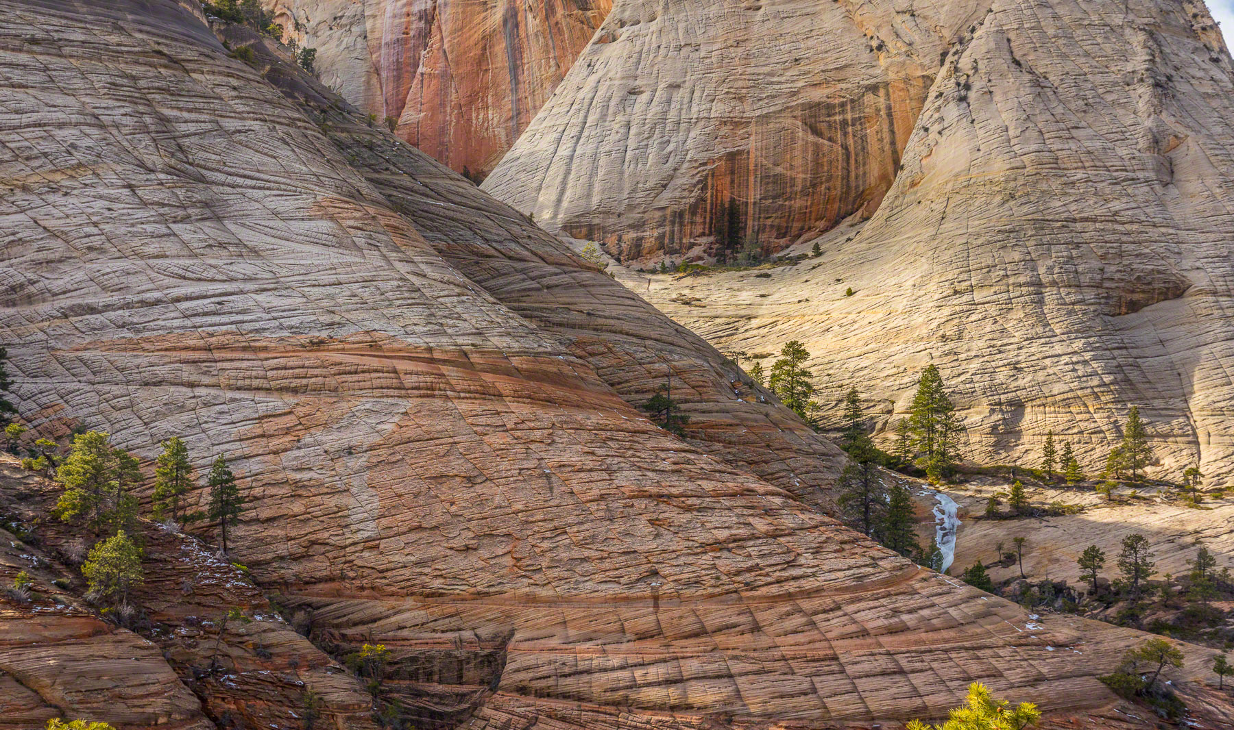
In winter the colors in the park are muted.

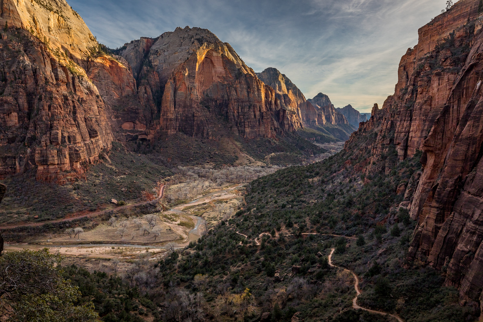
There are some great views past the Angels Landing junction.

For a short section the trail turns yellow.

A couple of California Condors were flying overhead. I think they have a nest nearby. One day i need to drag my telephoto lens up there.

For print and purchase options
As you move away from the rim the area takes on the characteristics of the Eastern portion of the park.
For print and purchase options
This is the kind of landscape I'm always looking for.
The way up to Angel’s Landing went quickly but at the split in the trail above Walter’s Wiggles I decided to take the West Rim Trail instead. I wondered if I might be able to walk cross country over the Imlay Canyon. That idea went out the window pretty quickly when I found the non-barren slopes so slippery with deep mud I was worried I would make too much of an impact, not to mention the danger of falling into a slot.

The West Rim Trail heads up towards the West Rim. I find it odd that they felt they needed to blast it into the rock.

An icy bridge crossing.


Getting up higher and it was a bit more forested.

I briefly thought that monolith up ahead would be a cool place to check out but the constant crackling of falling rocks scared me away.

The farther I went up the trail the snowier it got. Once the trail was completely covered in crusty slush I decided to find something to do in a drier area.

Back at the West Rim Trail I headed up until I decided it was getting too icy/snowy for my non-waterproof, light hikers. Confounded again, I still didn’t want to call it quits, so, on the way back i noticed some running water coming out of a canyon tucked away almost out of site above the trail. I scrambled up there and it led me through some rough brush into a hidden narrow canyon that, rather than pinching off in cliffs, ended in a steep slope of sand and forest debris.

I found a little trickle that led up to a cold brushy canyon.


The canyon ended at a steep pile of sandy debris made up of loose boulders and fallen trees. It was all held together by friction, and it didn’t take much to get things moving.

Looking down from about 2/3 up the slope.

When I made it out I was greeted by a hidden cove, and across the cove I could see the continuation of the weakness in the bedrock I had been following. This day I had a map and it said if I could climb up that last canyon I’d be able to walk over to Behunin Canyon and possibly look down into it.

For print and purchase options
Instead, because the day was getting late, I decided to climb up this cool looking pyramid.
With some effort I made it up the unstable, collapsing slope. Instead of a breathtaking reward i was met with… level ground. I had come out into the back of a hidden basin. The weakness in the rock i had been following continued on the other side of the basin and according to my map it would lead up and over a mesa to possibly look down into Behunin Canyon. I thought, based on my very recent success that maybe i should give that i try. The climb looked very similar.
It was getting late in the day though, and i was tired of pulling dead logs on top of me while i buried myself in cold wet sand and moss, so i went in search of that breathtaking view by climbing up a nearby pyramid shaped peak. Ah. NICE.

This mini-pyramid on top of the big pyramid told me I was not the first bloke to pass through the area.

For print and purchase options
The sun was getting low and the views were getting better.

I’d made my high point for the day and headed back through snowy grasslands.

Looking for a way back I got stuck in a Manzanera field for a while.

It wasn’t long before I busted out into some open rock. It was easy going so I followed this slope down as far as I could.

The slope dropped into a canyon so I continued along the rim.
On the way back I noticed I was on the wrong side of Refrigerator Canyon. That meant that I might be able to see Walter’s Wiggles from the opposite side, a short term goal that was easily pursued. Sure enough I was able to find a great viewpoint of the crazy switchbacks without any effort. What I did not know a time was that hidden in a Manzanera grove nearby was a couple of old NPS interpretive signs. Back in the 1930’s an official trail came through the area and the signs had been part of a viewpoint, now overgrown into obscurity.

Some of my Charity Work involves finding lost balloons and reuniting them with their owners. If you ever wondered where children's' birthday balloons go after they get loose, I can tell you that they go to the middle of nowhere, and I find them. I have found several balloons in the last year half buried and in the woods or in deep cracks.

I came across this metal stake far from the trail. I think it was part of an old trail that led to a now overgrown viewpoint.

Can’t get easier than this!

The Great White Throne and Angels Landing. I could see a few people on the top.

Here is a natural ice-slip’n’slide. I declined the free ride down.

That black streak is where the ice slide would spit you out. You can see it below the trees.

For print and purchase options
Just as the canyon rim above Refrigerator Canyon was tapering off I walked up to this great view of Walter’s Wiggles.

This final picture shows the entire trail coming in from Refrigerator Canyon, going up the switchbacks and exiting along the West Rim Trail and Angel’s Landing.