I think the most iconic mountain in Zion National Park is not Angels Landing but The West Temple. It’s visible from a ridiculous number locations in southwest Utah and is almost humanly sculpted to look imposing. The West Temple holds the title of the 2nd highest sandstone cliff in the Western Hemisphere. I haven’t looked it up but I’m sure the highest sandstone cliffs are down amongst the Tepuis of Venezuela where Angel Falls (interestingly named after an American Aviator) plummets over 3,000 feet.
Mt. Kinesava is directly joined to the West Temple and allows you direct access to that huge wall of rock.Paiutes named the mountain after a mischievous Coyote God, who was known to throw rocks down from above and start fires, alerting their Navajo enemies to their location.
Kinesava is imposing all on it’s own and is popular with technical rock climbers. There is one route though, that is accessible without ropes. The route is a very strenuous climb of over 3,300 feet, and involves several Class 4 scrambles. Notable people have died climbing this peak. Others have gotten lost. Good judgement and route finding skills are critical. There is no water or shade either, so the hike is mostly done on shoulder seasons where temperatures are cooler, the top is not icy and the days are long enough to complete the trek. It’s very important not to climb the sandstone in Southwest Utah for several days after it’s wet. It will crumble in your hands and collapse under half your weight. Because of all these limitations there are not many people who tackle the mountain.


The top of the slopes and beginning of the true climb. It takes hours to get to this point.

I did not like climbing up this ledge. You come up from behind where i’m standing on awkward, off camber bulges with exposure. I avoided it on the way down. This was also a real wake up call. After trudging up the hill all the way from those distant houses you have to suddenly make the transition to semi-technical climbing. You will not feel fresh.

This is shortly after the route becomes a climb up the cliffs for the rest of the way. It starts at the tree on the left and follows the bushes diagonally up the face.


There is some confusion at the very top of the cliffs about which way to go. There’s not really a good option but there is certainly a non-deadly option. My advice is once you are there, if you can’t decide between going left or going right, go straight up.

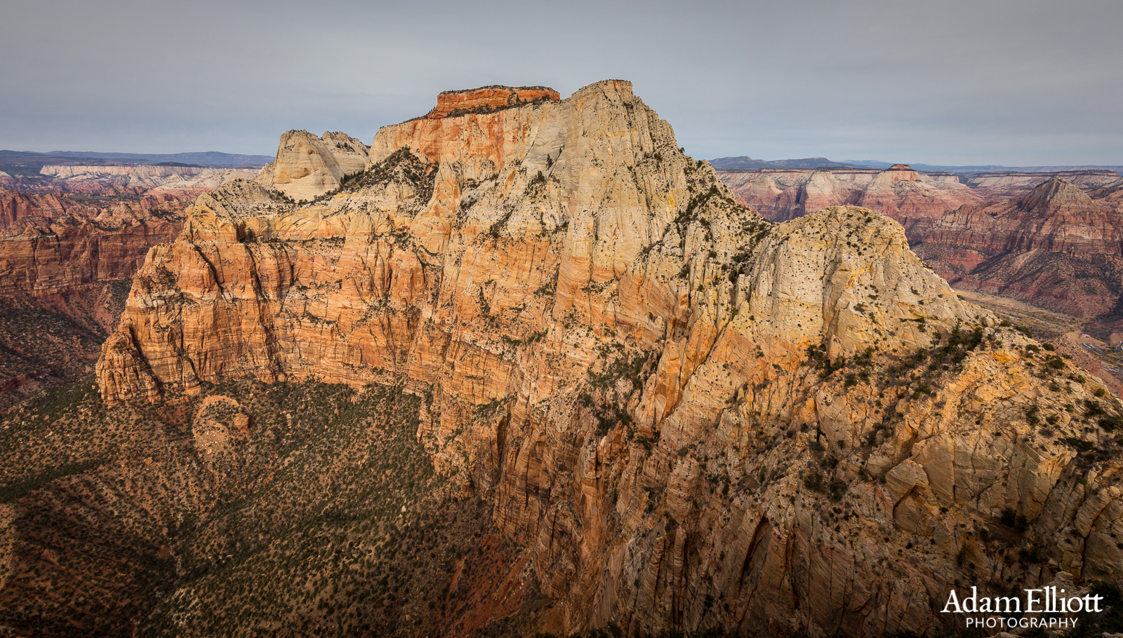
Finally on top of the cliffs and… It’s a false summit! In fact there is a whole hidden valley on top of the mountain. The white peak on the left is the true summit and is another 300-500 feet.
Looking down tremendous cliffs on the north side of the mountain. On the far left is a broad mesa called Cougar Mountain. I didn’t recognize it at the time but a few months later I climbed up there.

One thing i’ve heard over and over from reading route descriptions is that everybody who climbs the mountain wishes they had more energy or time by the time they are on the meadows. I’m no exception. There were at least 3 other places I wanted to go, like up here. The hidden petroglyphs are just to the left.

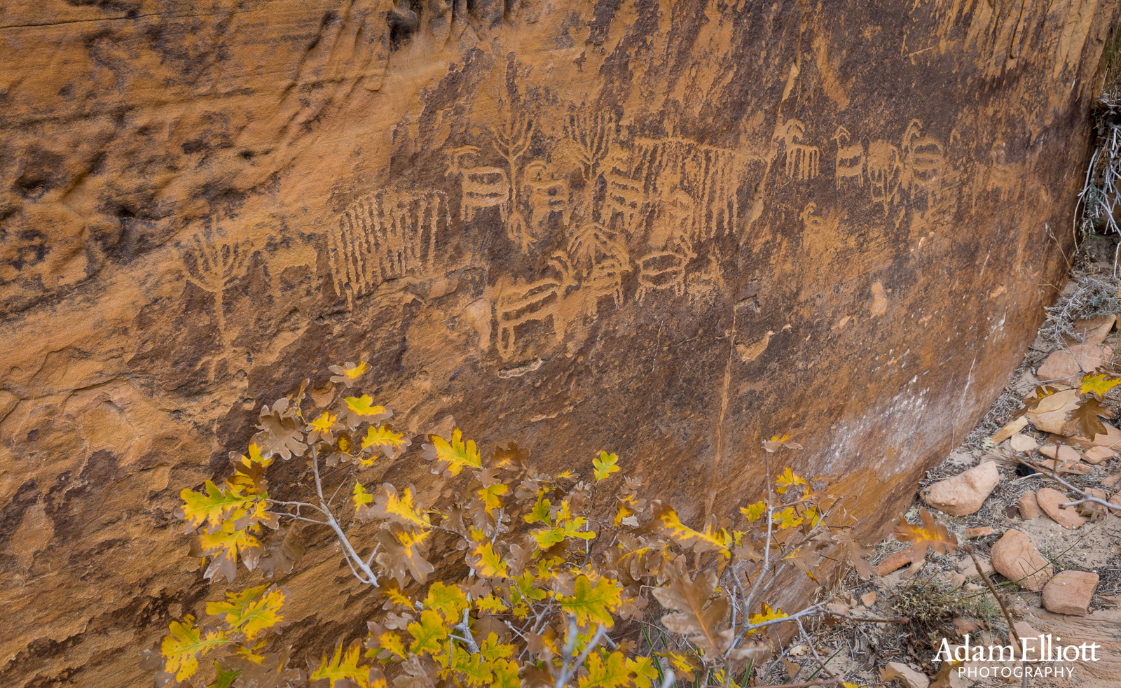
As cool as you might feel making it to the top of Mt. Kinesava you are far from being the first person up there. Native Americans have been climbing it for centuries, as these petroglyphs below the summit show. They didn’t have any fancy gear either.

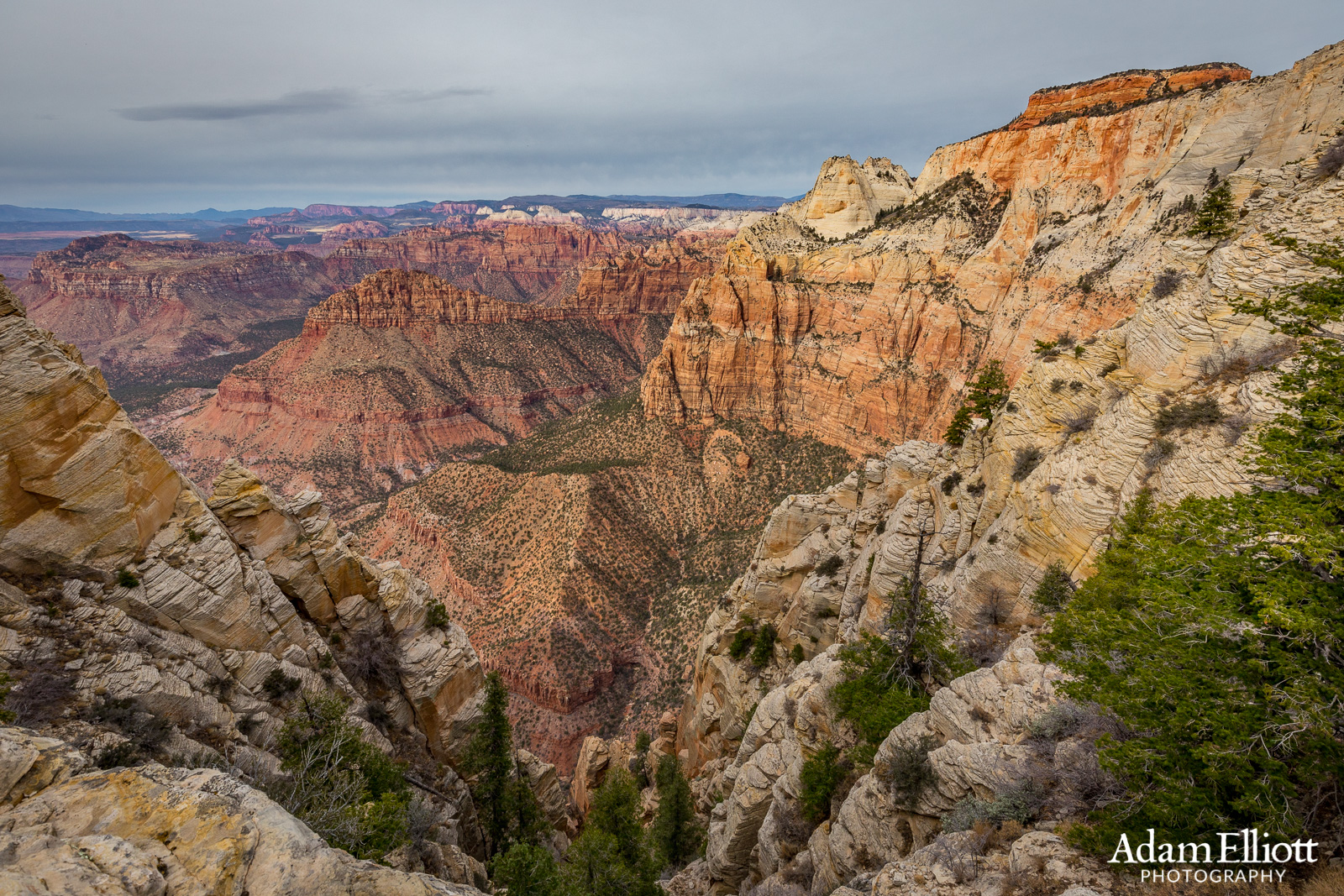
One more view to the north. All those white cliffs in the distance are the most remote part of Zion.
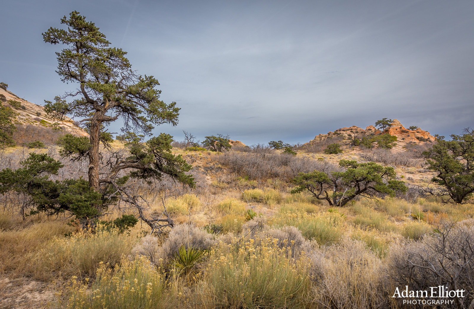
It’s kind of a peaceful place on top of Kinesava, and totally isolated. Although, I never did shake the feeling that I was on top of an immense tower. This is what high desert meadows look like that have never been touched by cows

Well, time to go back down. This would not be fun. Across the valley you can see the East Temple and a good view up the east side of the park.

Kinesava is one of the few places where I greatly appreciate the placement of cairns to mark the route. Can you see the one at the very bottom, just right of center?

Descending the last band of cliffs.

It looked like it might rain. I only got a few drops but I did not make it back to the car until twilight. The clouds thickened, causing it to get dark at least 30 minutes sooner than it should have. Directly across from me is Eagle Crags.