I have driven by Red Canyon dozens of times and never stopped. It always shows up in the middle of getting to Bryce or Escalante or Zion. So one day after spending a weekend in Bryce and knowing the forecast was set to go downhill I decided it was time to check it out, rather than waste good weather hours driving back to Zion. I was glad I did. There was only one car in the parking lot and on the trail I only saw one couple in 3 hours.
Red Canyon is located along Scenic Byway 12, about 9 miles west of Bryce. In fact, for tourists travelling east, the canyon, which can’t be missed, probably tricks them into thinking they have arrived at Bryce earlier than expected.

Just like Bryce, Red Canyon is in the Claron Formation.

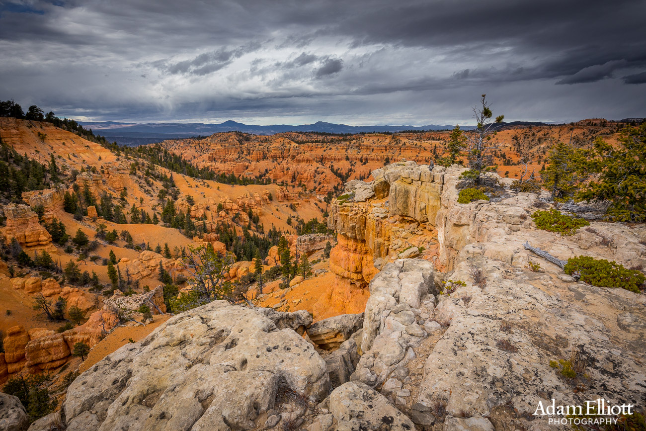
The trail I was on had some limestone caps in places and the trail wound through scattered, tortured trees.

The highway runs between here and the distant forested hill but there are trails for hiking on both sides.

Other parts of the trail, especially the beginning, were in Ponderosa Pine groves.

It was very windy and the weather was dramatic. When I saw the totally insane looking storm forming on the upper right, I began to worry I might get stuck in a hail storm with no shelter.
I wanted to really give the area a good look so I opted to do one of the longer hikes. I started on the Cassidy Trail and made a loop by taking the Ledge Point Trail and the Rich Trail. There were ample signs for navigation and the terrain was never very rugged. I think the loop was around 6 miles.
Red Canyon is made of the same rock layers of Bryce, minus the topmost layers. Most people who visit Bryce only ever hike on the topmost layers, so Red Canyon does offer something new, or at least allows you to simulate starting off a hike lower down in Bryce Canyon along the vibrant and sparsely forested hills. Other parts of the Red Canyon area allow horses, bikes and even OHV use.

Looking towards the distant Markagunt Plateau.

The canyon got more and more interesting the farther up I travelled. Eventually it reaches the cliffs of the Sevier Plateau, which rises to over 11,000 feet.

I decided to see if I could get on top of this battleship formation.


The side of that battleship formation is far narrower than it looked.

The limestone cap.

On top of the coral textured limestone.

Scattered trees and vibrant Claron sediments.

A curvy tree under curvy sheets of rain. The clouds were ripping across the sky.


Looks like mountain bikes were allowed on the trail.

The beginning and the return of the hike is in the bottom of the valley along the dry riverbed.