For print and purchase options
I’m currently 45 blog posts behind so I need to crank out at least one of these a week for a year. This week covers a little adventure on the south side of Tabernacle Dome. That doesn’t sound like much, but if you’ve ever seen the south side of Tabernacle dome you might notice that it’s unreachable. Tabernacle Dome itself is a worthy goal but it requires just a little bit of technical climbing with ropes. This other cool and underrated blog has some good pictures of that route.
South of the dome is a high plateau. The top is a hidden wonderland of brush. Yes, a wonderland of thick brush, punched through with a maze of rock towers and hoodoos. This anti-human “garden” is surrounded on three sides by precipitous cliffs a few hundred feet high. It’s a lot like a miniature Tepui. The north side of the plateau is completely blocked by the dome.

Following the old road that used to lead to the cabin makes the initial approach easy.


A nice fall day at Tabernacle Dome. One of the clefts on the right-side photo is the official way to get to the top.

This is a dryfall that marks the beginning of a deep slot canyon behind the dome. When climbing around trying to find a route around the east side this slot acts as a barrier and hazard.

See, I told you it was deep! It’s important not to fall in there.

Another view above the slot. On the other side is the Eastern flanks of Tabernacle Dome. You have to scramble across that to get to the southern plateau.

Looking back at Adam’s Knoll.😀

This flat resting point is just after the most exposed part of the scramble around the side of the Tabernacle. It’s a nice spot for a break. There is a seep spring nearby and it has a nice view of the South Guardian Angel, pictured here.

After some more scrambling and bushwacking I arrived. This is the first view of the plateau beyond Tabernacle Dome. It was late in the day and didn’t look any easier than what I had already come through, so I decided to return the next week.

On the way back I stopped by that slot. You can see here how the slot (below me on the right) is part of a fault line that continues across several valleys and slices through cliff after cliff. In the distance it seems to divide the West Temple from Mt. Kinesava. On Google Earth is looks like it slowly bends but continues all the way to Arizona! Pretty cool.
I would have done this exploration years ago but property issues made access very difficult. There was a cabin directly in front of the dome and a fence along the road. You can even see the cabin in that blog I mentioned above. It was like that my whole life. Then, I guess whoever lived in that cabin must have died and the family who inherited the property either sold or donated it to the park service. The park service then removed any trace of the home and has attempted to erase the road leading to the property. The fence has also been removed.
Walking along the base I found a way around the east side of the dome. Once I accessed the plateau, which took quite a bit of time, I realized the landscape was brushy and complex enough that I’d have to come back another day to explore it. I returned 6 days later, while the route was still fresh in my head. This time I made it up there much earlier in the day and spent the afternoon working my way through the maze until I made it to an abrupt and flat overlook into the Left Fork (aka The Subway Trail).

Six day later I returned, much earlier in the day. This is the rarely visited south side of Tabernacle Dome.

Despite saving a ton of time by knowing the route, I now had to spend a ton of more time finding routes through the maze of hoodoos and trees on the top.


Some of the rock formations on top. They alternated between being curvy and whimsical to looking like they were sliced by lasers. The rock on the left in the foreground looks like a giant Planarian.

I slowly made a lot of progress until I came to this pesky wall. I tried several routes around it that were dead ends. I thought I might have to try and climb the tree.

My last chance I found this route up around the cliff. It was nice to see I could still continue beyond.

My options for walking started running out and before long I was traversing along the crest with some seriously nice views. In the distance on the right side is Cougar Mountain, a very strenuous trip I did a year later.

It was weird to be hiking cross country for hours and come out so close to the road. It’s a sheer drop right over there.
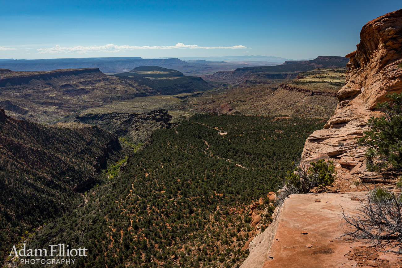
This was it, as far south as I could go. I completed my goal. Below is the Left Fork. The little dirt clearing near the center is the parking lot for The Subway. I had walked along the trail from there, staring up at these cliffs, wondering how to get up here. In the far distance are the Beaver Dam Mountains. In the foreground you can see a crazy, ridiculous network of social trails people have made through the juniper forest while they try to find their way to and from the parking lot. That’s what happens when you don’t have an official, well maintained and marked trail for a very popular hike.

Looking up the Left Fork. I may have been able to frame this better if I had been paying more attention but this a pretty unique view. From right here you can see both the narrows of the Left Fork AND the Right Fork at the same time! The Right Fork is on the far right (duh!) just peaking into the frame. On the left you can also see the North Guardian Angel.
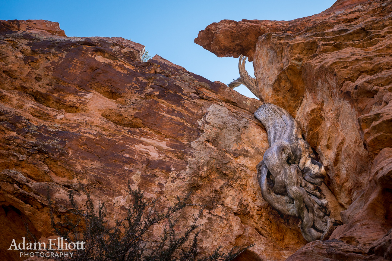
An scraggly tree whose roots are growing down like a blob looking for a hole.

Towards the road the plateau disintegrated quickly into plunging holes between towers of rock. I had spent the whole day climbing up and down rocks and shoving through trees across this kind of terrain. I was getting tired.

One last isolated area I explored had this nice sheltered overhang where I sat and had lunch, looking over the Kolob Terrace. Like i said, i was getting tired, so i took a nap here. It was great!

Looking over at Lambs Knoll (far right) across the road. Pine Mountain in the distance. This area was interesting because the joints in the bedrock all seemed to be tilted to one side.

The seep spring I mentioned earlier.

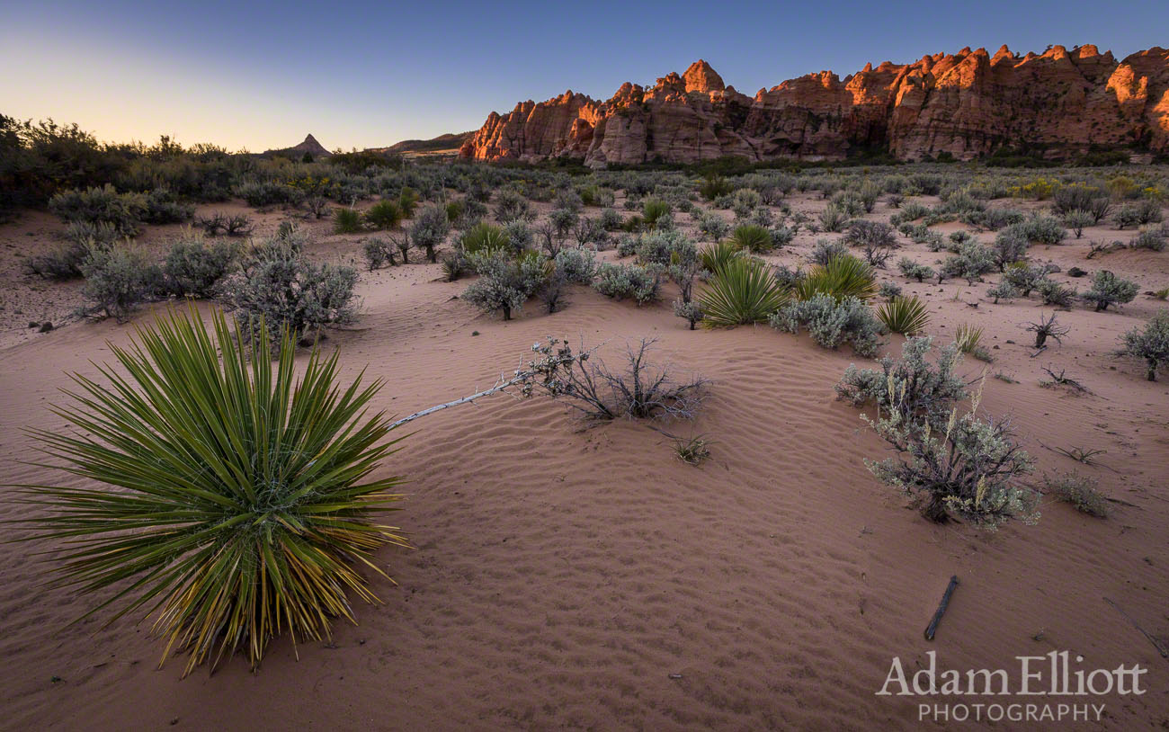
As the last rays of the sun hit the hoodoos the sage starts to feel like it is air conditioning the desert. It’s a real relief.