For print and purchase options
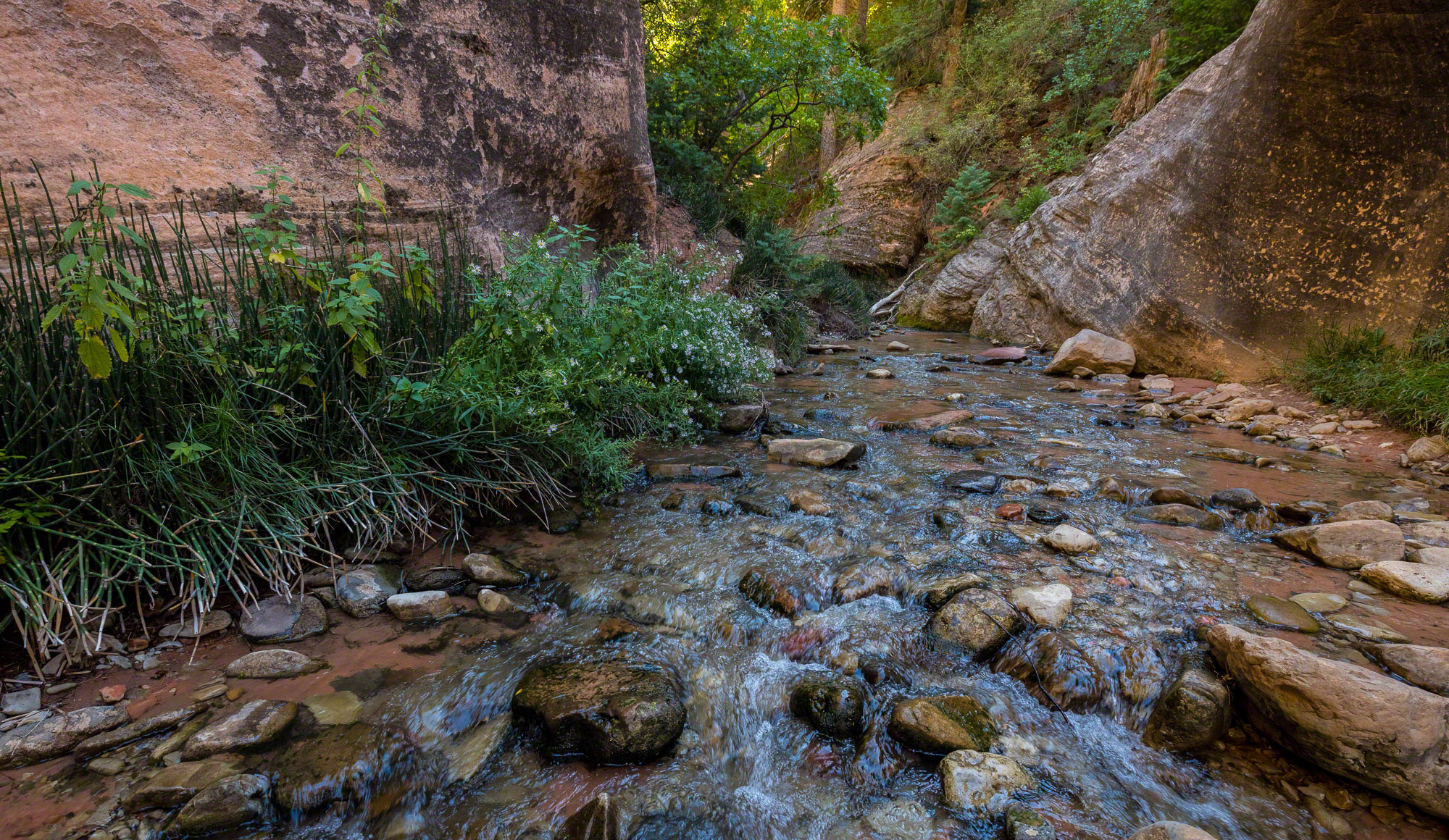
I have known about Kanarra Creek for many years but I never felt like going because I always read that it was very short and very crowded. Both are true. While it is an exceptionally beautiful little water hike cut through the same rock as the Kolob and every bit as nice as Zion National Park, it lies well outside the boundaries of the park.
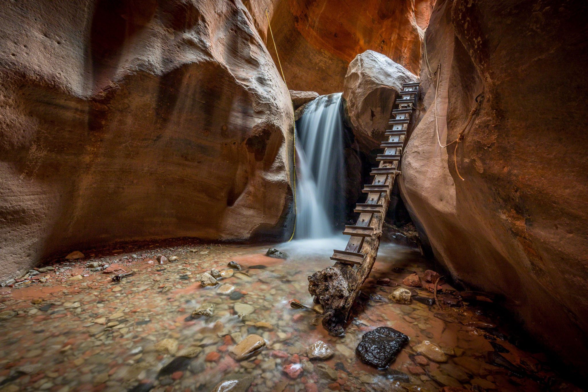
Kanarra Creek can be very crowded, with long waits to climb up the two main waterfalls, or while wading through the narrowest sections of the canyon, but we seemed to hit it just right on the way up. As we walked up the hot dirt road, which accounts for half the hike, we passed a constant stream of people who were leaving the canyon. Once inside, we were fortunate not to see many people through the narrow portion of the canyon, but on the way back out we encountered a bottleneck at one of the falls where a group of a over a dozen people were climbing up the log one at a time. It took us a good 6 or seven minutes until i sort of just grabbed my chance to go down.

The first mile you walk along a hot dirt road through the Hurricane Cliffs Fault

The first thing you pass at the top of the hill are the water tanks for the town of Kanarraville, filled with water from the creek.
The first thing you pass at the top of the hill are the water tanks for the town of Kanarraville, filled with water from the creek. After that you walk along the first mile on a hot dirt road.

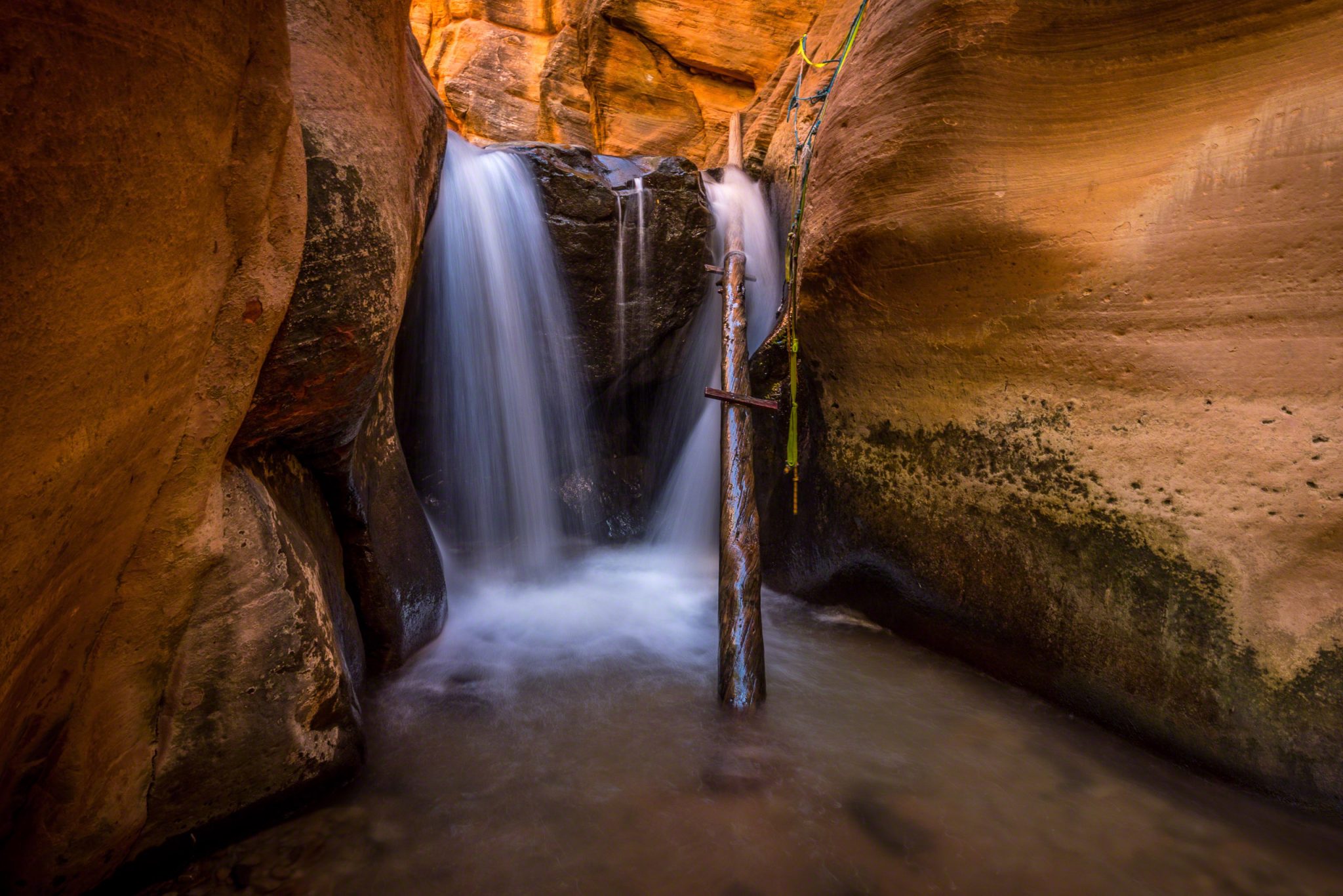
Crossing a trail washout along the waterpipe. I have heard it was repaired in the spring of 2017. (We visited in September 2016)

Passing through the fault line of the Hurricane Cliffs, which hide the canyon from view.
Crossing a trail washout along the waterpipe. I have heard it was repaired in the spring of 2017. (We visited in September 2016). Shortly after passing through the thick fault line of the Hurricane Cliffs, you will arrive at the canyon proper.
Kanarra Creek can be very crowded, with long waits to climb up the two waterfalls or wade through the narrowest sections of the canyon. We seemed to hit it just right on the way up. As we walked up the hot dirt road, which accounts for half the hike, we passed a constant stream of people who were leaving the canyon. We were fortunate not to see many people on our trip through the narrow portion of the canyon, but on the way back out we encountered a bottleneck at one of the falls where a group of a over a dozen people were climbing up the log one at a time. It took us a good 6 or seven minutes until i sort of just grabbed my chance to go down.


Above the second falls is an area of recent rockfall that killed a number of trees.

The fresh hewn rocks on top of the other sediments and the stripped bare trees remind you to keep your eyes and ears open.
There’s an area above the second falls is an area of recent rockfall that killed a number of trees. The fresh hewn rocks on top of the other sediments and the stripped bare trees remind you to keep your eyes and ears open.


Kanarraville is a very small community a few miles south of Cedar City, and the town gets most of its water from Kanarra Creek. This has become a problem in recent years as the number of people who visit the canyon has skyrocketed. The Iron County Tourism Bureau heavily promotes visitation to the area internationally, and word has spread about the hike via the internet. Many of the visitors throw trash in the creek, leave clothes in the creek or defecate on the river banks. It’s a very short hike so i don’t know why people can’t plan ahead just long enough to avoid that, but I have heard it happens often and we saw evidence of it happening during our visit too. The creek and the hike cross through three bureaucratic management areas with some of it near BLM land, some of it on SITLA land and some of it municipal. The overcrowding and poor human behavior degrade an otherwise great little hike, and with the water supply for the town being at least somewhat threatened it’s possible access may be limited in the future, if bickering management agencies can’t agree on a way to patrol the area and keep it clean.
