For print and purchase options
Death Valley: Darwin Falls
Categories: California, Hiking, Mojave, National Parks
After our first rainy day in the park we decided it would be a good idea to head to the visitor center to get information on road conditions. There had been extensive flood debris everywhere we went on the first day, and a lot of my options this trip were via dirt roads. It was a good thing we went. Nearly every single dirt road in the park was closed to flood damage. Scotty’s Castle was closed until the next decade. I’d also hoped to possibly see a superbloom of wildflowers but the rangers told me that despite all the recent rain we were still about three weeks early for that kind of display.
With virtually no options left for me other than what I’d already seen on past trips, we decided to go on a hike to Darwin Springs. The Darwin Springs trail is on the upper slopes of the west side of Panamint Valley. Oddly, I did not know Panamint Valley was part of the park until this trip. To get to the trailhead turn off Hwy 190 a mile west of Panamint Springs and follow the dirt road 2.4 miles to the parking area. The hike is very easy to the first falls and is a distance of 3.1 miles round trip, depending on how far you go. From the first falls it’s possible to climb up much farther to several other falls, one of which is the highest waterfall in the park at 80 feet.

For print and purchase options
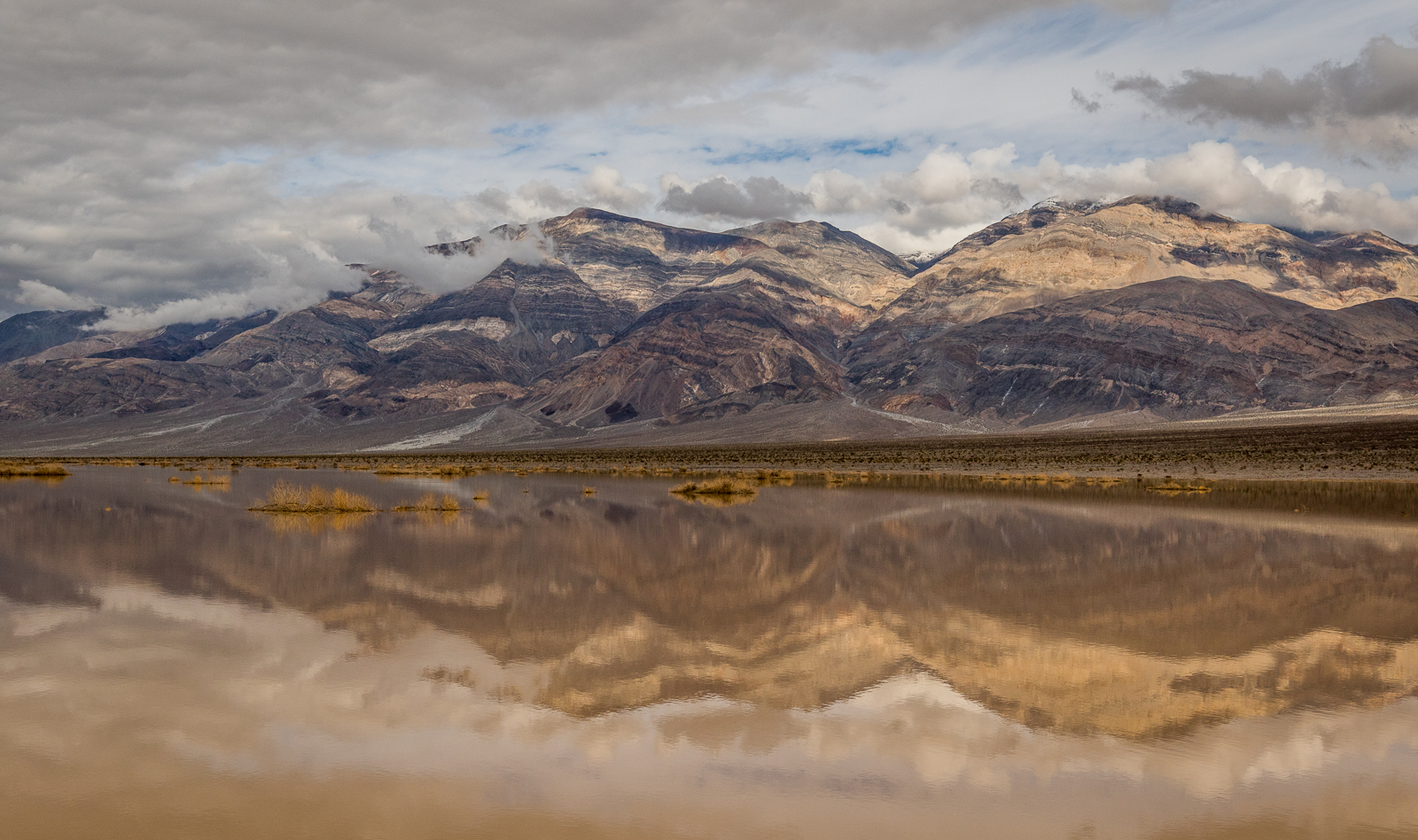
The rain the previous day had flooded the dry Panamint Lake creating an amazing reflecting pool.

The distant Panamint Dunes appear almost as a mirage from 9 miles away. I’d had enough of staring at them and decided I would return one day and go over there.
For print and purchase options
Panamint Butte thrusts up over the lake.
For print and purchase options
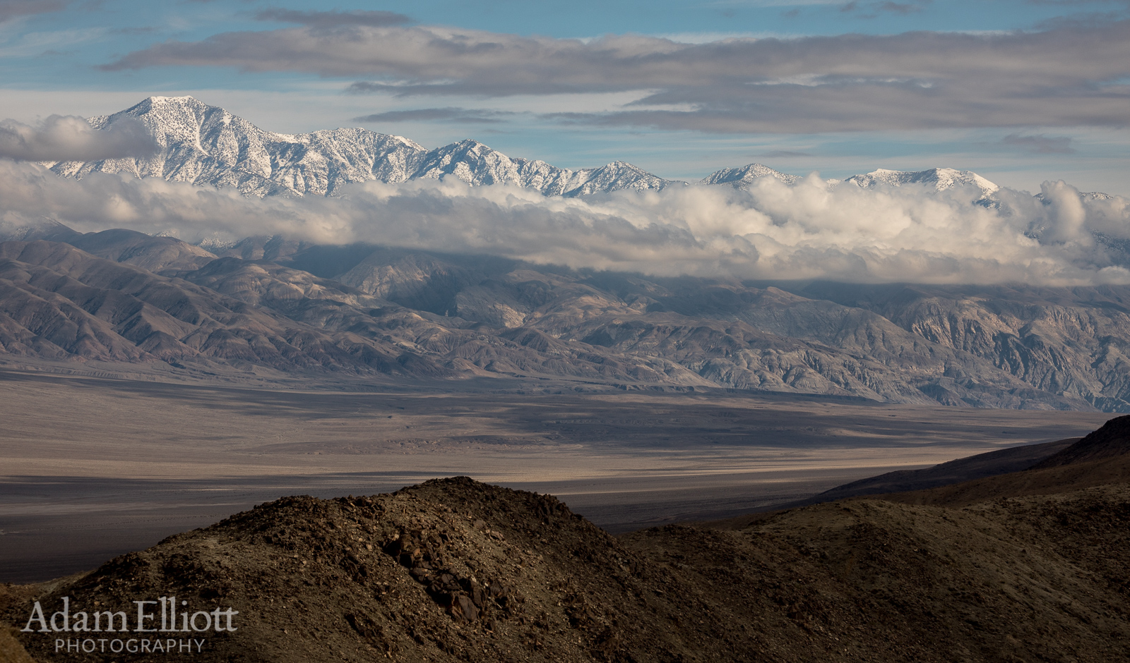
The Panamint Mountains had a fresh coating of snow. Temperatures that day at Furnace Creek were in the mid 80’s.

A close up of the layered limestone and marble of massive Panamint Butte.

Walking down the beginning of the Darwin Springs Trail.

The half shod pipeline that runs by much of the trail was leaking gratuitously.

The cliffs had some really interesting colors and metallic sheens. Here they are blue and green!

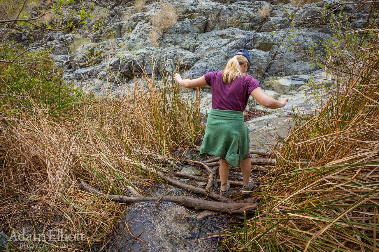
There are a number of slippery little log bridges like this, so getting your feet wet is a real possibility. Things could be worse in Death Valley.

Kona tests the depths.


The trail eventually changes from a gravel path to some light scrambling up sometimes slippery rocks.
This hike doesn’t necessarily have national park quality scenery but it is a genuine oasis water hike. We also enjoyed the ample amount of shade in the narrow canyon. There is an active water pipe along much of the trail.


I don’t really know why these people were going this way.

A slide!

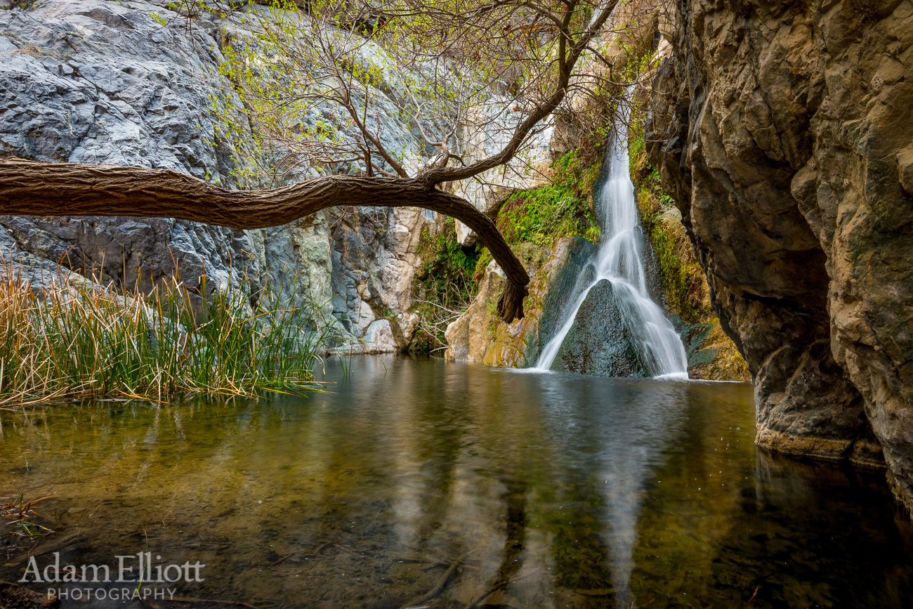
Lower Darwin Falls. From here climbing becomes more difficult and up high cliffs. With Kona’s tendency to be clumsy we decided not to go farther.
For print and purchase options
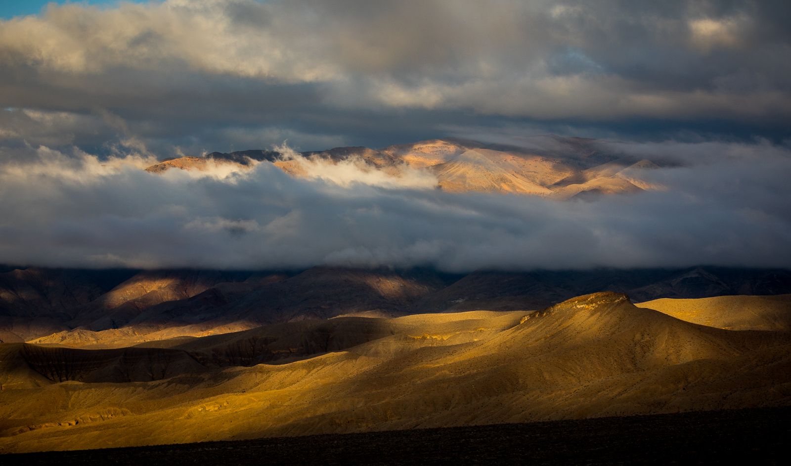
Driving over the Panamints back into Death Valley proper the clouds were still heavy over the mountains.
The next morning was still very cloudy and humid. On the way out of Beatty we decided to ride up to an old mine area at the base of some very gloomy looking mountains. There were several operations going on but part of it seemed to be a marble mine. I think it is called the Carrera Mine.


It was cold and windy that morning. Maree wasn’t into it.

Layers of marble and limestone at a high angle made the mountain really interesting. There is a lot of cool geology around Beatty, and thus a lot of mines.
Highway 190 ascends steeply over the mountains between Panamint and Death Valleys.