
Lamanite Arch
Categories: Utah
Lamanite Arch is in a remote canyon found in Grand Staircase Escalante National Monument, near the Circle Cliffs. I had been wanting to go see this arch for years and noticed a few roads get pretty close to it. So last October I decided to try out a serpentine route that might get me there in only 3 miles.
My first major disappointment of the day was that the road I wanted to take from the Lampstand area was washed out at least a mile before I wanted to stop using it. And it coincidentally happened to stop being usable at the bottom of the steepest part of the road. So that automatically added an extra strenuous mile in and one extra less-strenuous mile out, already making the route, possibly, not the shortest option. Then again, I don’t know what the the other roads are like either.

The first thing I had to do was climb over the Circle Cliffs. This semi wooded badlands area is where the cliffs break up enough to climb over them. This picture was on the way back but for narrative purposes it makes sense to put it first.

It seemed easiest and most fun to descend down this Chinle Ridge.

There was a lot of petrified wood in this canyon but not as much as Egg Canyon, to the south.

I was one canyon north of Egg Canyon, which was on the other side of these cliffs.

Some fall colors in The Gulch. This was the least interesting part of the hike but the fastest travel by far.
The sun was already pretty high and while i think the total distance to the top of the cliffs is less than two miles, it’s rugged at times, and I wasted some energy climbing up and down the wrong washes in an unpredictable badlands area full of steep soft slopes and deeply twisting ravines in the Chinle Formation.
My second disappointment was the evidence of major cattle ranching once i got into The Gulch. There are cow trails everywhere and once i got into the canyon containing Laminate Arch, I ran into a herd of cows that looked like they were pretty much camped out there. I was surprised because the whole area is in a wilderness study area, so I wasn’t expecting commercial ranching.
The canyon has what seemed to be a permanent stream but it was seriously polluted by the cattle and had nearly turned into a smelly, trampled marsh. Even though I kept trying to get around them the cows would freak out and charge in front of me a few hundred yards up canyon. Then i’d have to go through the same hassle again for well over a mile.

Well that’s cool.

Finally in the canyon containing the arch. The cliffs were already getting more interesting.

First view of the arch. The canyon is narrow and brushy, and there is a very deep sandy gully a few feet in front of me. That makes getting a good viewpoint considerably difficult.
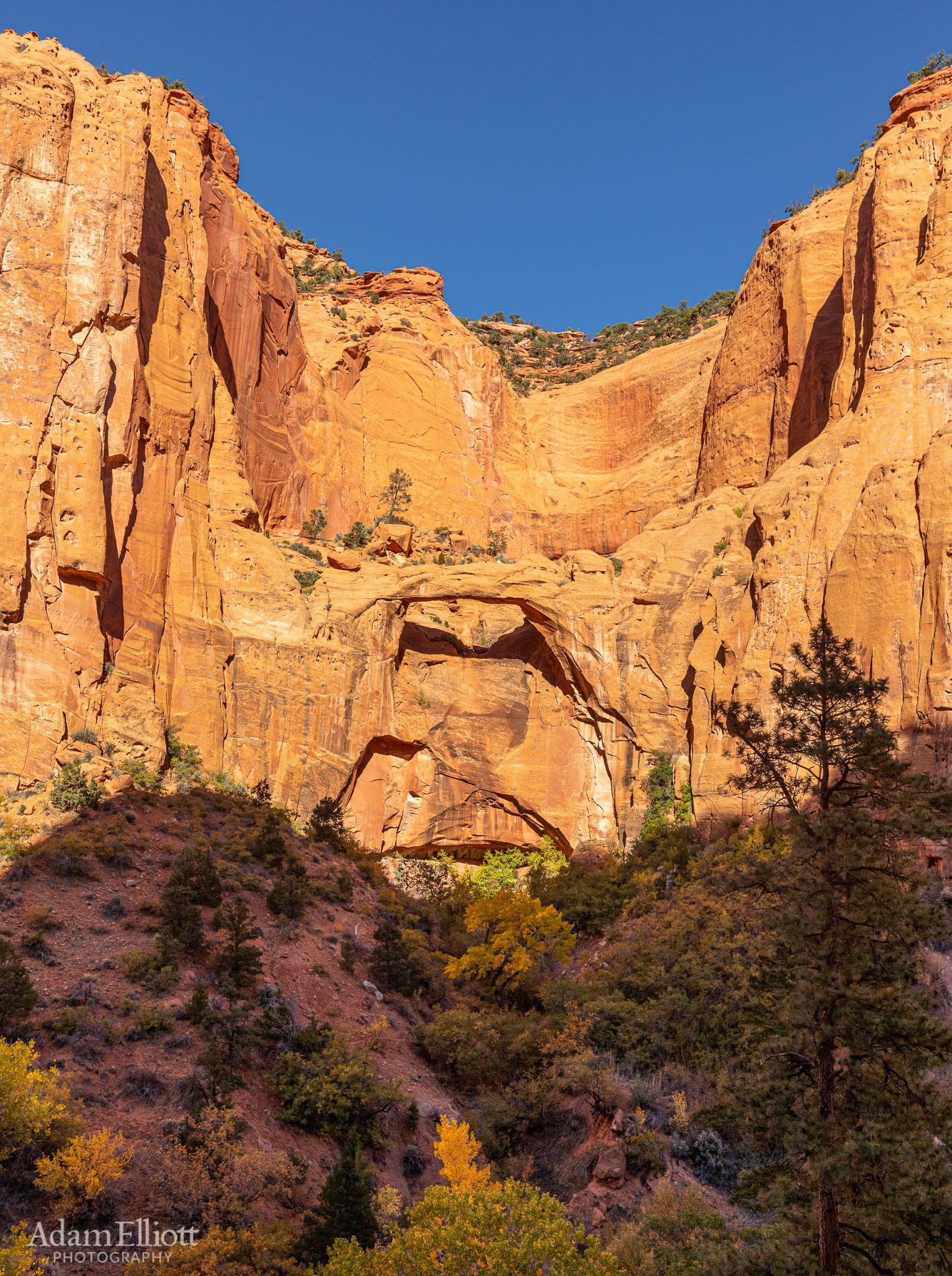
Head on view from across the canyon. From this angle I think it’s pretty clear that the name should be Lamanite Natural Bridge rather than Arch. So.. it could be really cool here during a heavy storm when there could be a waterfall!
Other than the cows I had a great time. The arch was really cool, the canyon containing the arch had a very remote feel with outstanding sandstone walls, and in general the route offered a lot of variety and problem solving.

I had heard of the arch before but was totally surprised by this fantastic free standing rock pillar. It took me a while to scramble up the side of the canyon and get a less obstructed view. In the meantime the shadows were quickly devouring it.

It looked very inviting to continue heading up canyon but I was out of time (not to mention tired) and I knew those idiot cows were huddled up there some where. The main canyon heads 90 degrees to the right of here, but doesn’t go far.

Looking down canyon from my perch opposite the arch.

Late enough in the day the canyon walls were beginning to glow, this nice peaceful area had a strong breeze in the trees. There was a trickle of a stream at my feet, feeding all this vegetation.

Payback time. Going up this crumbling steepness to get to the next canyon.

So, another option is to begin from another road that ends at the head of that distant canyon wall in the center. Impossible Peak on the far left.

The view going up. Kind of a hidden basin back here.

Up high enough, now I needed to work my way over to the first gap in the cliffs.

Looking back at the slope I traversed. Impossible Peak left of center.

On top of the gap in the cliffs.

The other side of the Circle and the Henry Mts. in the distance. I had to go straight down and then cut around past the far left of the picture.

One last look at the remote canyons I’d spent my day exploring. Boulder Mountain in the far distance.

Down from the cliffs and the more remote canyons but I still had quite a bit of navigation to do before dark. I kept getting pushed into the head of Egg Canyon. The view was good but I needed to not lose altitude yet.
Back on track and really enjoying the change to vivid purple in the badlands.

A Slot Canyon! No time.

There were several arches or holes in the top of that mesa. I kept an eye on it as i walked around it to make sure i wasn’t hallucinating but they were definite there.
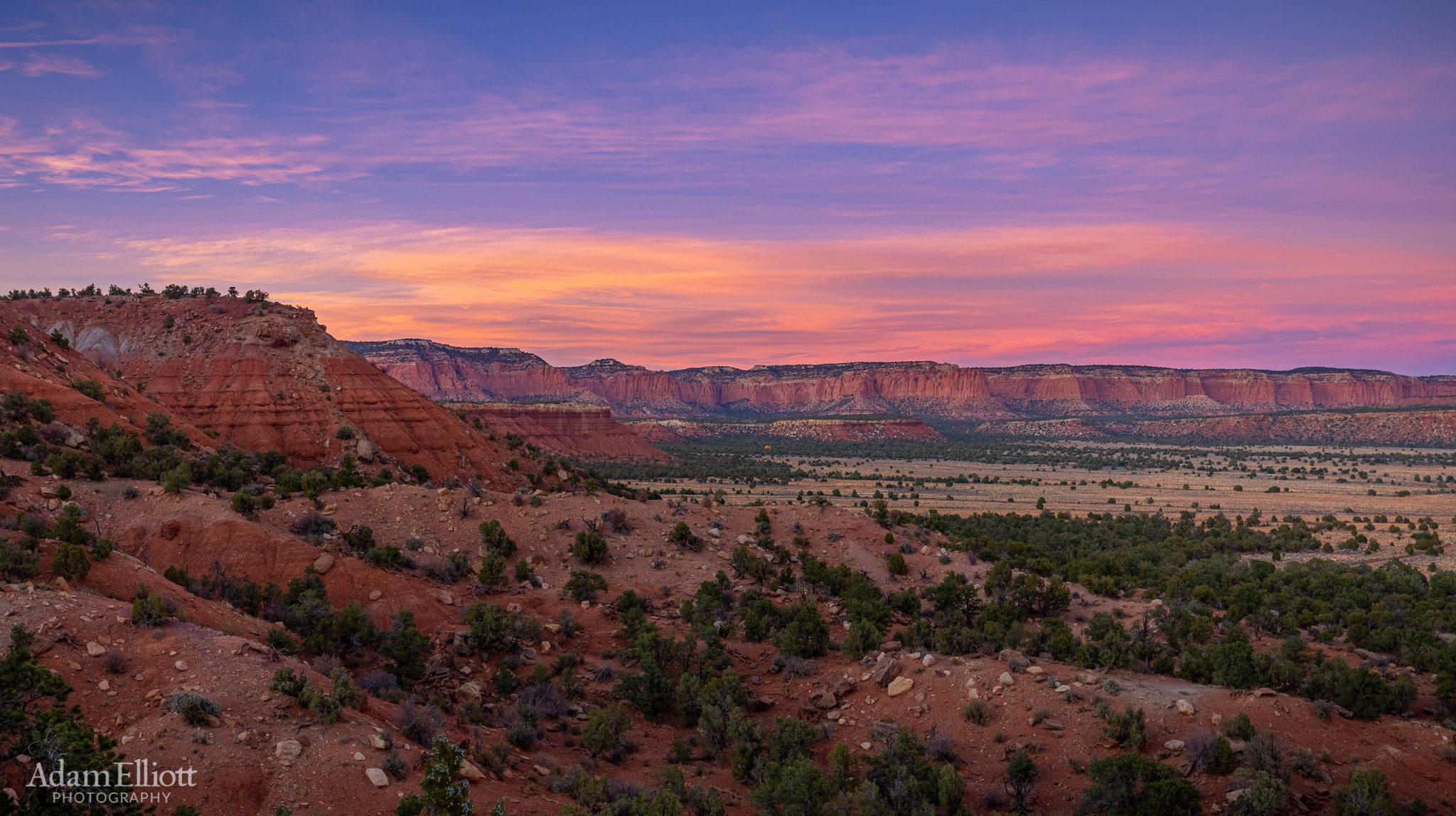
A beautiful sunset over the Circle Cliffs.

Finally spotted my car, just as it was almost dark. The end of another great day.