
The Ruby Mountains are an isolated and glaciated granite mountain range in northeast Nevada. I first heard about them from my next door neighbor in Alaska years ago but last summer on my way back from Montana I was finally close enough to justify a side trip and see what was going on over there. I was glad I did.
The Ruby Mountains were originally called the Humboldt Mountains, named by John C. Fremont after Baron Friedrich Wilhelm Heinrich Alexander von Humboldt (1769-1859). Yeah, you know, that guy (actually he’s pretty cool). While the river and the national forest still carry the name Humboldt, the mountain range has changed to ruby because of some guides who went panning for gold and found garnets, but mistook them for rubies. The name caught on, for whatever reason, and now everything in the region is incorrectly named after rubies: Ruby Valley, Fort Ruby, Ruby Dome, Ruby Lake, Ruby Marsh, Ruby Valley Pony Express Station, Ruby Range, Ruby City, Ruby City Creek, Ruby Crest National Recreation Trail, Ruby Siding, Ruby Valley Indian Reservation, Ruby Hill, and Ruby Wash.

The beginning of the trail at the Lamoille Canyon parking lot already had very desirable scenery. This was a great relief because most of the valley is burned up until the last few miles.

The weather was fantastic, if a bit chilly for August. Looked like it was going to be a great day.
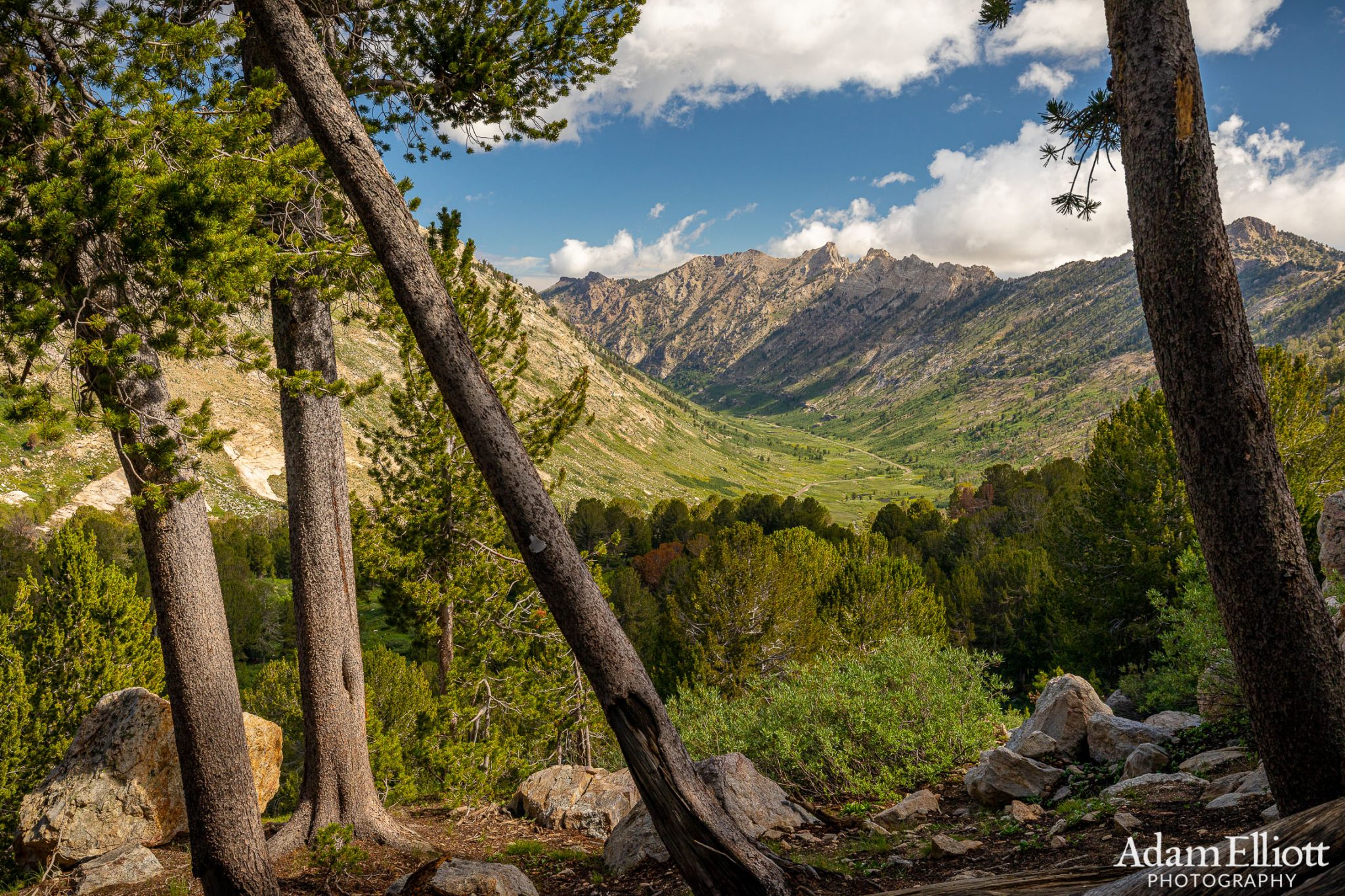
Getting high enough to see down Lamoille Canyon. I can forgive someone for mistaking a raw garnet for a ruby (they are very similar) but can’t forgive calling a glacial valley a canyon, so from here on out i’m calling it Lamoille Valley.
When I arrived, I had just done two off-trail, somewhat treacherous mountain hikes in Glacier National Park. I was primed for some more glaciated mountain exploring. From what I had read there weren’t a ton of trails in the area, so I decided to take a route that would allow me to see a lot of the immediate area in one day, connecting at least 8 lakes, to make a 10 mile loop. It would be half on and half off trail, and get me across several valleys and passes. The first several miles of this route took me on the most popular trail, up to Liberty Pass at 10,450ft.
Weird fact: the Ruby Mountains are the only place in North America where you can see the Himalayan Snowcock. They were introduced as a game bird in 1963 and have established a population above treeline. I have no idea what the negative effects of that were on native wildlife but it’s neat to be able to see a Himalayan bird in these sky islands. I kinda wish they’d introduce some Alpine Ibex. I’d enjoy having to worry about being killed by one of those, and i want some pictures.
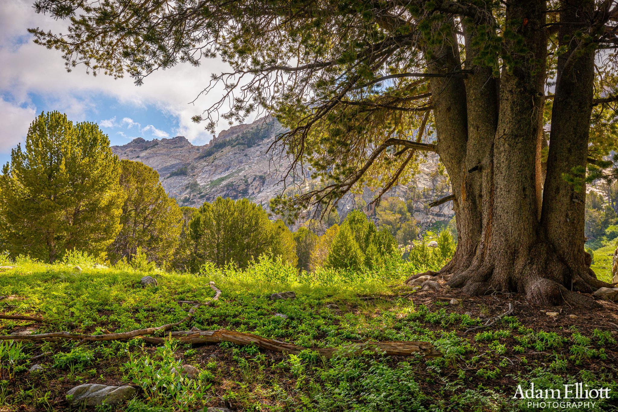
Pleasant vegetation on the ground. Things seemed to bloom later in the summer here than up in Glacier near the Canadian border.

Something i really enjoyed about the Ruby Mountains was the young healthy forest of Bristlecone Pines. They seemed even healthier than at Great Basin National Park.
You pass at least three lakes on the way up to the pass.

High in the valley the land became terraced and reminded me of the Sierras. Liberty Peak in the distance at 11,00o ft. I was supposed to be going up there.

I enjoyed having a trail and shade.

Treeline! And it looked like the pass was just ahead a bit more.

Lamoille Lake below. Once I was off the trail and was done with the summit I was supposed to follow that ridge on the far left for a while and drop into a place called Box Canyon. Eventually I would come back to a trail in that shaded valley on the far right. It was good to get an idea of the size of the terrain.
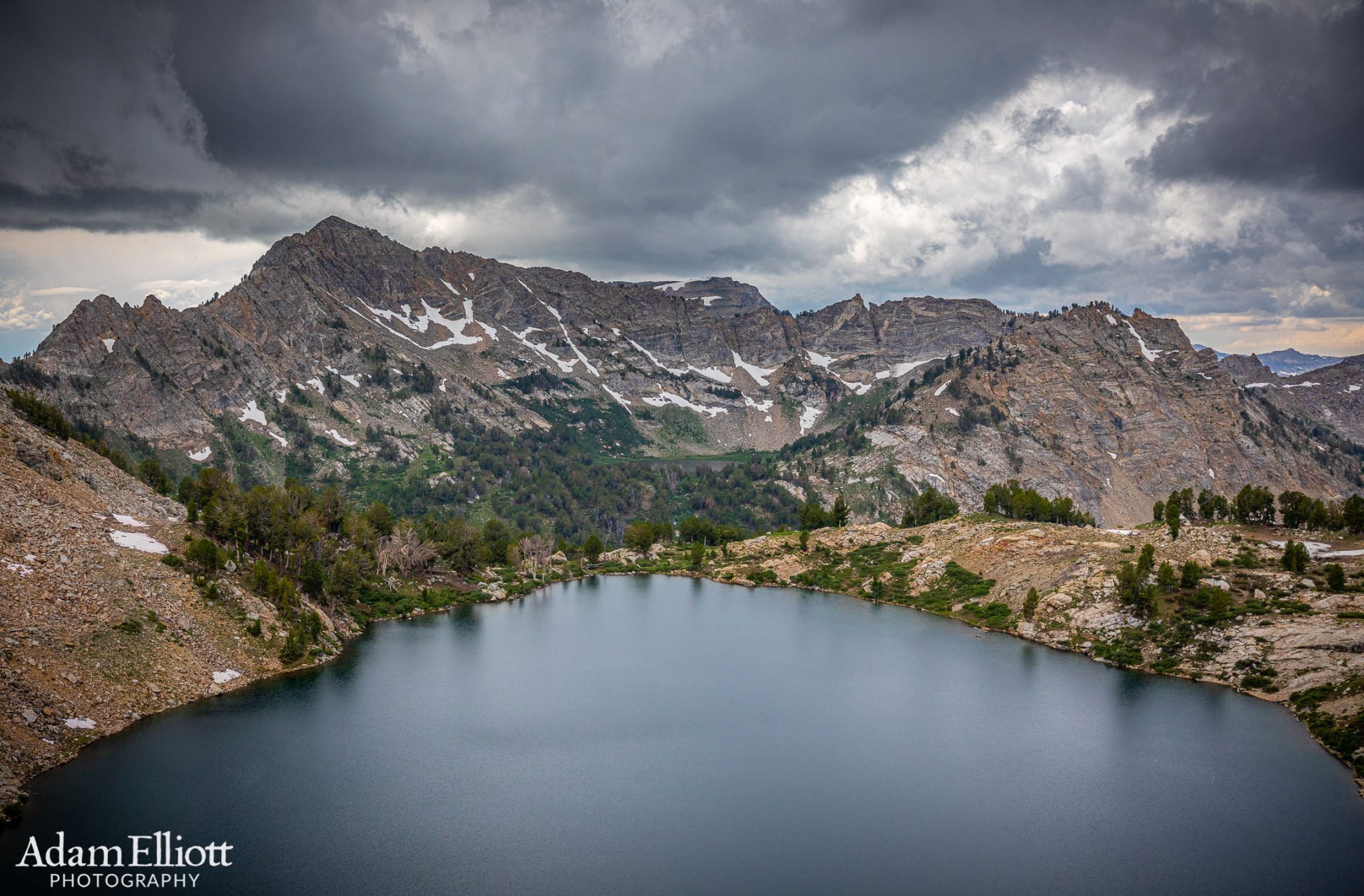
Above is Liberty Lake. The viewpoint here is a few hundred feet lower than the pass but less than 1/2 a mile away on top of a cliff almost straight above the water. Across the valley is a great view of Castle Lake beneath Lake Peak. Liberty Lake is beautiful when the sun shines on it, but at this point I had decided I should abandon my original plan. As you can see in the picture is was already looking gloomy. Gloomy is fine with me but the deal breaker was that in every direction were rapidly growing cumulus towers. I could feel the instability in the air and it was far too early in the day for the stage that things had already progressed. I decided to play it safe and head back the way I came. I’ve already had my fill of violent mountain storms on exposed ridges and steep wet slabs of granite.

It already started to rain by the time i had started descending from the pass.

Snow Lake Peak in the distance. 11,137 ft.

I was tempted to take this snow chute as a short cut but it was too thin.

The rain was light and pleasant, and it brought the color out of the plants.

I don’t know what the vivid green plants next to the snow were.

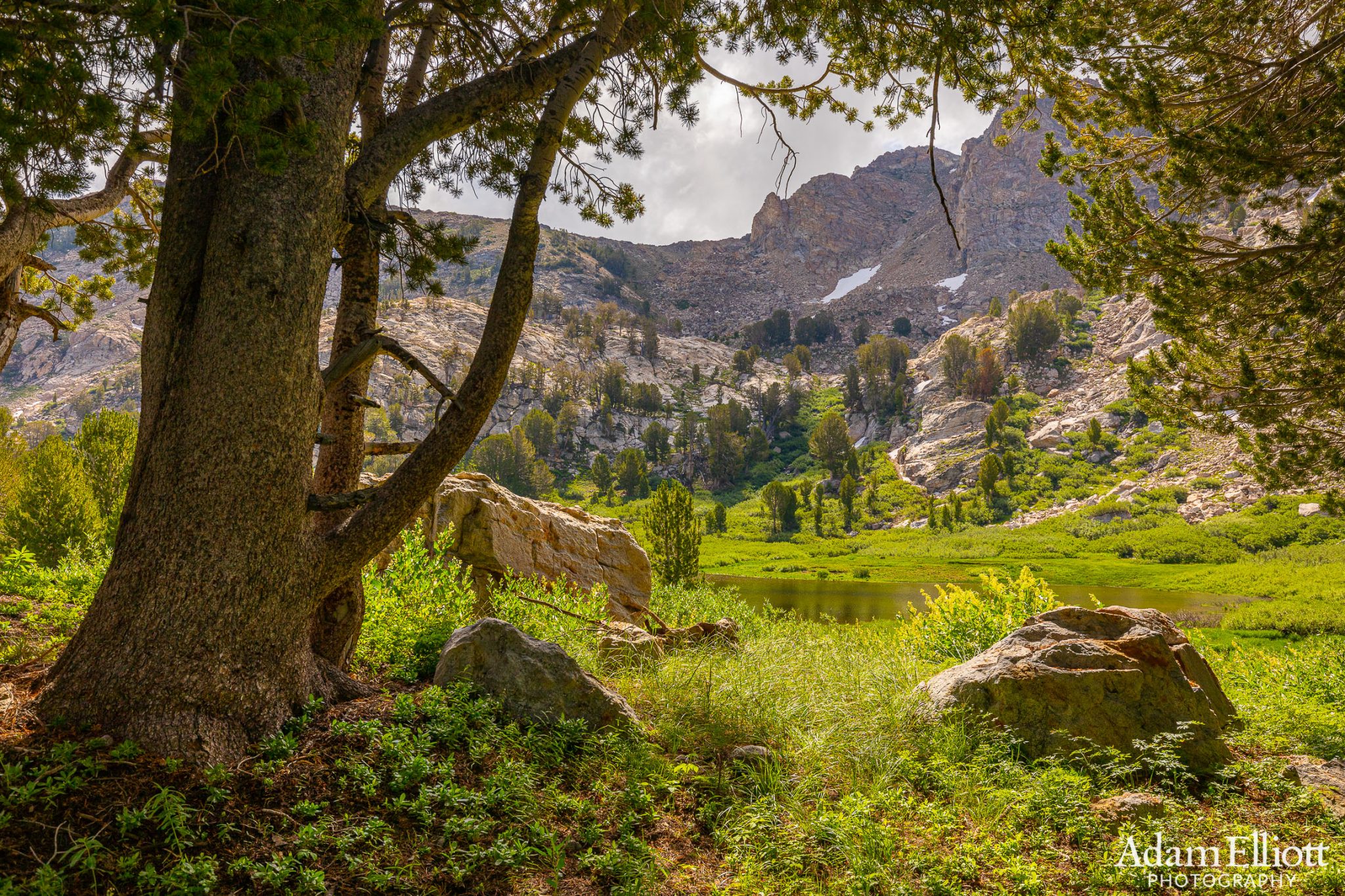
Nice dense patches of young bristlecones.

Some great park like terrain.

One of the two “Dollar Lakes”
The rain had been light and steady. I thought I might get off easy. But the clouds were getting very dark behind the pass where I’d seen the lake. At some point I looked back and saw what looked like a volcanic eruption. A huge plume of clouds rose up behind the valley headwall at a high rate of speed. It was more like they were being pushed rather than rising of their own accord. After they rose about 400 feet they started coming back down at the same rate of speed, on my side of the mountain. I knew at that point I was going to get nailed. I was 3/4 of a mile from the back of the valley but in less than 60 seconds I was hit by a violent wall of wind and sleet. The sleet was joined by hail moments later. Then the temperature plummeted like a ghost had entered the room. I had to seek shelter under a tree and immediately and put on all my clothes.

I quickly started looking for a tree that could withstand 4,000 years of mountain storms. This one looked good.

Under the tree it was getting so windy that by the time I started getting re-dressed i had to kneel on my clothes to keep them from blowing away. And then….

Really nasty! This was the worst summer mountain storm I’d been in for decades. The tree I picked out for shelter was fantastic. I was barely getting wet at all. This was maybe two minutes after the previous picture.


It was much colder after the second storm. All the extra weight i’d been complaining about on the way up was paying off now, including gloves.

This is how the day ended. But the storms weren’t over. They continued to grow, and followed me all the way back to Elko, where there was some violent rain after sunset. Additionally all the lightning had started a brushfire west of the mountains and it closed the highway i was taking the next morning. I think they had just closed it after i had already gotten on it, so I had to backtrack 12 miles and take a very alternative path that was over 100 miles of dirt road around the other side of the mountains.


As I mentioned, most of Lamoille Valley is burned up. But there was fresh spring growth coming out of the ashes. Unfortunately it does ruin miles of otherwise pretty scenery. The misty rain created outlines of the U-shaped glacial valleys.