Glacier National Park: The Pinnacle Traverse
Categories: Hiking, Mountains, National Parks
I worked in Glacier National Park for 3 summers in the early 1990’s. Things were peaceful back then. The first summer I worked at Swiftcurrent Motor Inn and noticed the bedding in the amphitheater on one of my many climbs up Mt. Henkel reminded me of what I’d seen in pictures of the Grand Canyon. So the next summer I went and worked down there on the South Rim. But, to me, the Grand Canyon was not nearly as impressive as the mountains of Glacier Park. The next summer I returned to Swiftcurrent, and the summer after that I tried Rising Sun, just for quick access to another area of the park. During those three summers I summited 16 individual mountains, including Mt. Cleveland, and hiked over 325 miles (close to half of the trails in the park).

A calm morning on Lake Sherburne.
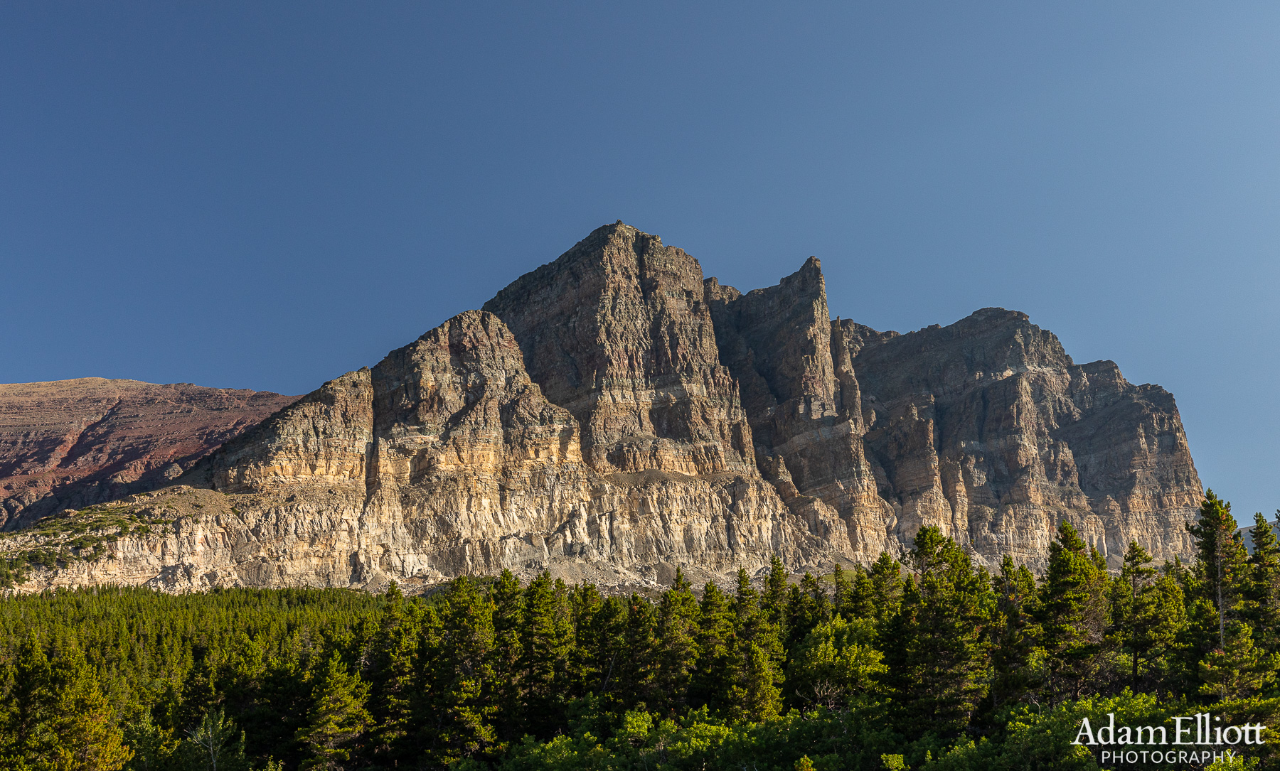
Among the many familiar sites driving into Many Glacier Valley is Apikuni Mountain, the abrupt end of the mountains, as if they hewn apart with a great axe.

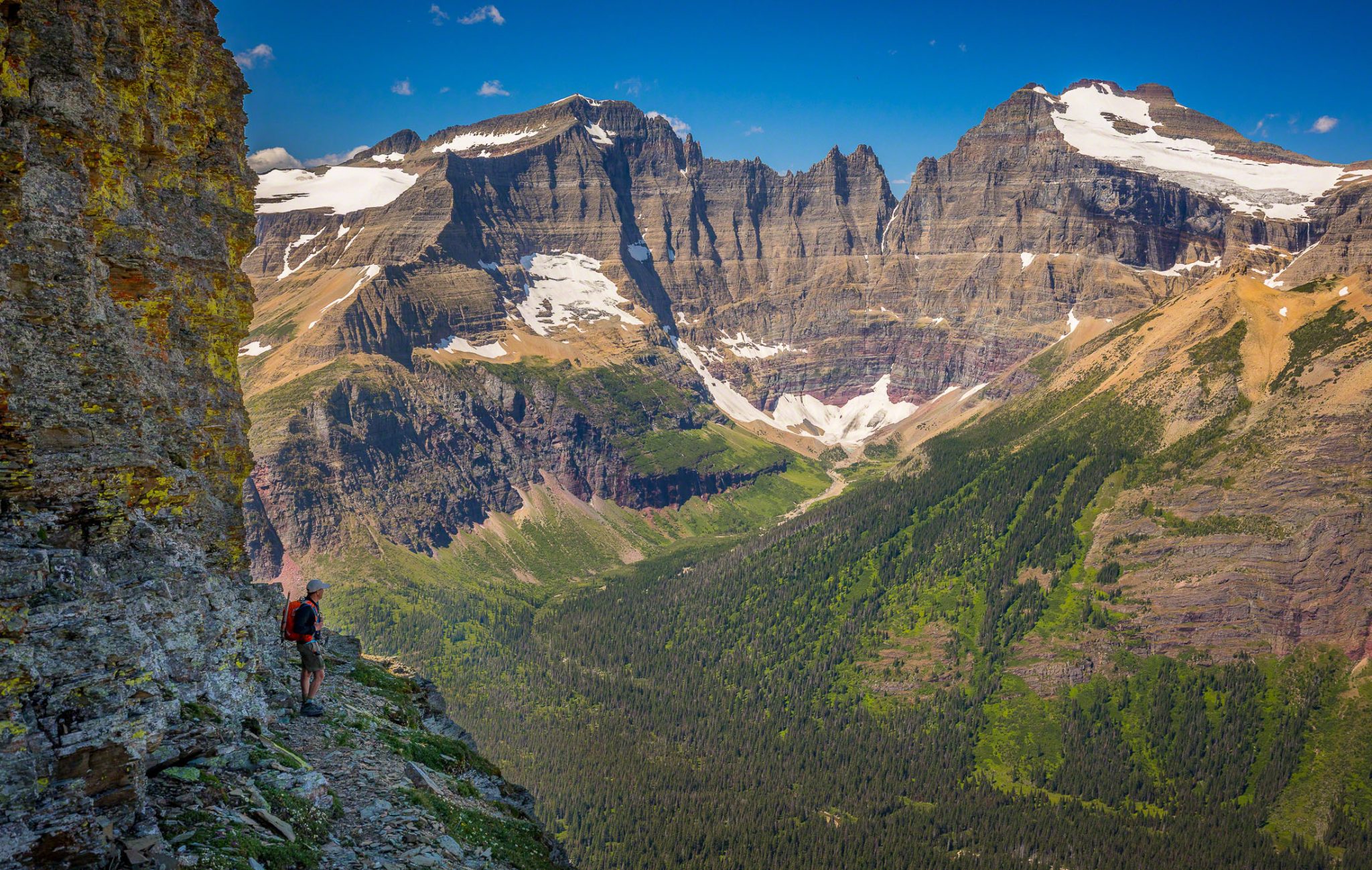
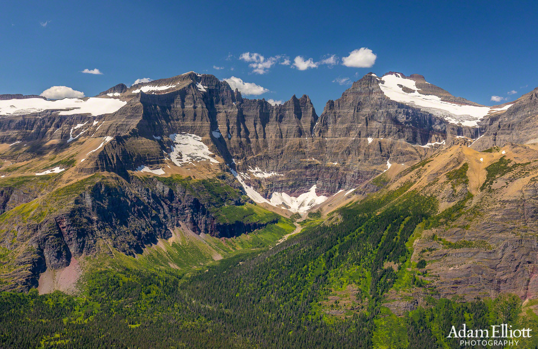
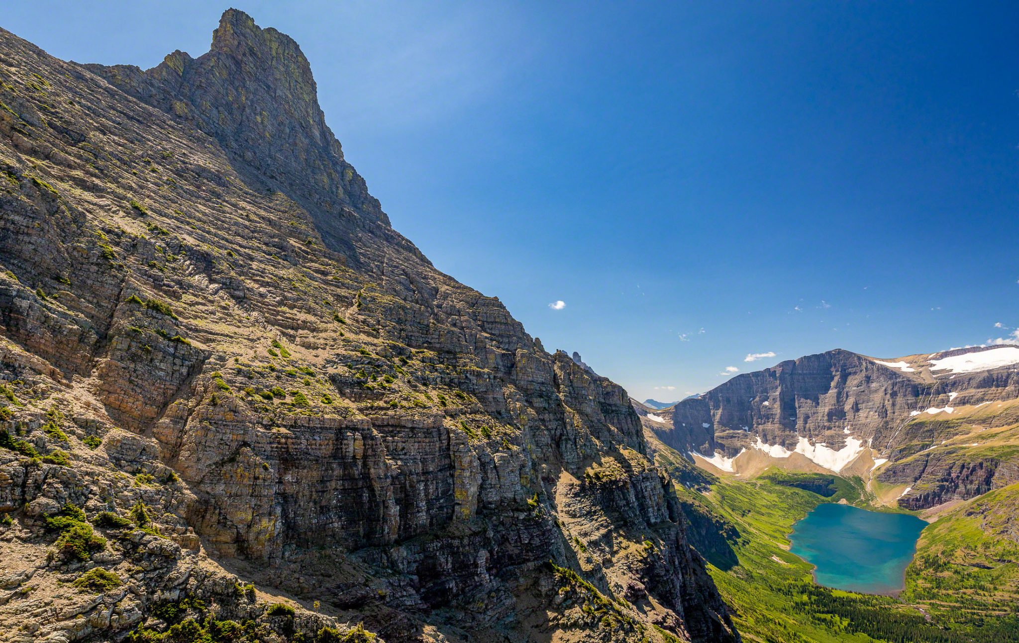
This is a view of the Pinnacle Wall. Our goal was to traverse along a very narrow, exposed goat trail on the other side of it and come down over the top next to Iceberg Lake.

Mt. Grinnell. I think I approached that one from Swiftcurrent Pass and went down the Grinnell Lake side.

The beargrass this summer is amazing.

The long switchbacks to to Ptarmigan Tunnel.
I returned to Glacier for a reunion of Swifties in 2001 but I had not been back in 18 years! That’s a long time! So this summer when I went to visit my friends from that first year, Jodi and Stephen Schultz Smith, I had to decide what to do, after having done so much already and after so much time had passed. Jodi and Stephen met in Glacier at Swiftcurrent that first year and later got married!
As far as options, something that had always nagged at me over the years was my attempt long ago on an off trail route called the Pinnacle Wall Traverse (now also called Ptarmigan Wall Traverse by some). The route was pioneered by legendary local climber J. Gordon Edwards and is a 4 mile route along a very narrow (at times) set of goat trails that stretch from near Ptarmigan Tunnel all the way to Ahern Pass. The route often includes route finding, great exposure, and sometimes a little climbing. The slow nature of the travel can make the trip a very long day, well over 12 hours.
The beginning is confusing because there is more than one goat trail to choose from. Originally I chose the wrong trail, which shortly ends in dreadful cliffs. Stephen had done the route twice so he agreed to take me along on the hike again, with one of his friends David Koel. I had never met David but we readily agreed to risk our lives together for an entire day.

The outstanding cliff face on the other side of Ptarmigan Tunnel.


The view from Ptarmigan Tunnel towards Elizabeth Lake was just a short diversion before we got down the real business of the day.

We attained the ridge, which on old maps is considered part of the Pinnacle Wall. Stephen stands in front of the distant ridge to Crowfeet Mountain.
The beginning of the real trek. Doesn’t look bad at all but right around that corner it gets more serious.

The beginning of one of the exposed areas. We were walking around the corner of that cliff right behind his head.

The route consisted of very exposed, frightening sections spaced out by wider areas like this, where you could regain your composure. I have to admit it had been a long time since I’d dealt with that kind of exposure. I’m used to huge desert cliffs (where the footing underneath is rock solid and free of clutter). From this “safe” area we were heading for the sunny ledge right the the lower left corner of the lake. The trail is so narrow it doesn’t even look like it exists.

Some really cool, free standing pillars. You could walk around them.
A fantastic view of Ipasha Peak, on the left, and Mt. Merritt on the right. Old Sun Glacier pours waterfalls off the summit of Mt. Merrit. This view alone meant my day was a complete success! To get an idea of the size of that cliff it’s more than 3 miles away.
We made great time that morning but when we hit the wall the hours started bleeding by. The trail is not maintained of course, and can change over time. A couple of times we seemed to lose the trail but it was always a short climb up or down from where we were. Eventually we ended up on top of the wall itself, standing beneath an enormous and incredible monolith of rock sometimes called “Ptarmigan Spire.” It had been 9 years since Stephen had done the trail and the problem was, there didn’t seem to be a trail up there. He did find some goats, but they offered no advice. Because of how long it had been taking and a few other factors we decided to try and just go down the east face of the wall, rather than go back. That in itself was a daunting task and took an hour of downclimbing cliffs before we got to the safety of the skree below.

Looking back towards Lake Elizabeth before moving out of view.

Lake Elizabeth was replaced by this even better view of Helen Lake and Ahern Peak. Following the ridge of Ahern Peak to the left you see a distant, shallow, u-shaped pass. That is the continental divide and marks the end of the traverse. Below that pass you can see Ahern Snowfield. It’s known to be steep and dangerous enough we had brought crampons, ice axes and harnesses/rops just for that obstacle. That is about 3 miles away. From the pass we would climb over Iceberg Notch and down to the lake. From here it’s less than 3 miles as the crow flies. But that previous picture of Mt. Merritt is still over 3 miles away. I measured three times to be sure. That is a huge cliff.

We lost the trail at an undesirable place and were discussing where to go next. Stephen seemed to be looking up at an area hundreds of feet above us.
This is where we lost the trail. Stephen had decided we needed to climb up to the base of that peak in the far top of the photo, and possibly traverse the side of it. This is a huge chunk of the wall. Often we were only able to see the part we were clinging to the side of.
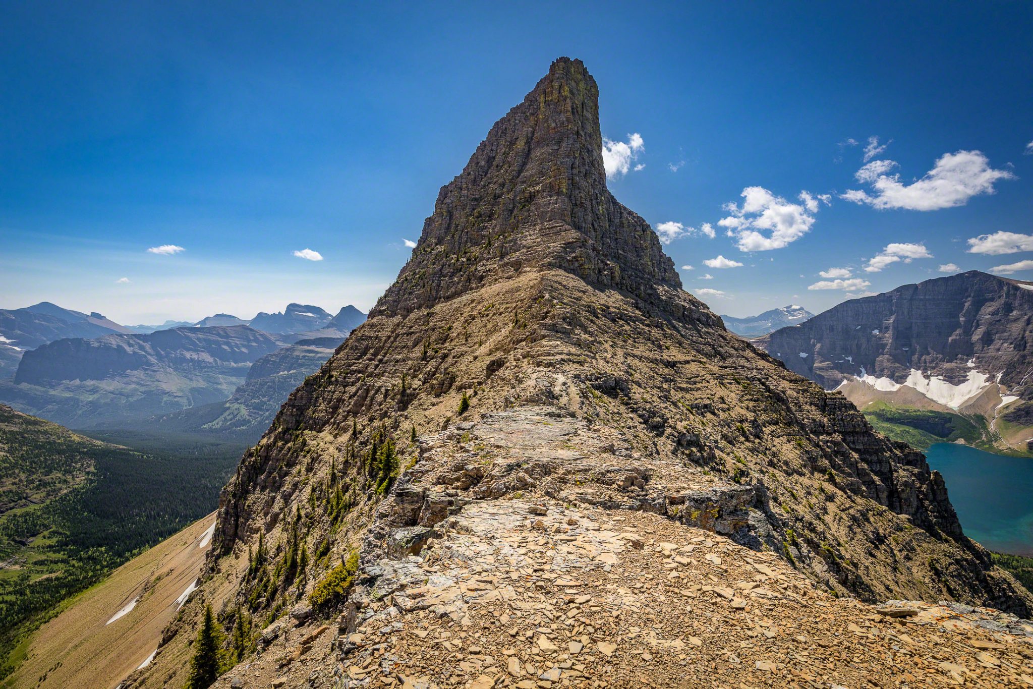
Woah! So we climbed up to that base of that pinnacle, and it was an amazing place to be! This was on top of the wall with views off both sides. There are trees on the cliffs way up there. I was amazed at how flat it was in places. Stephen went up higher to look for the route. It’s possible an avalanche or major storm had blown the rocks away or buried the trail but after looking at Google Earth, it’s clear we should have done as Stephen suggested and traversed the right side of the peak. We were about 25% done at this point but had completed most of the climbing and one of the slower sections of the route.

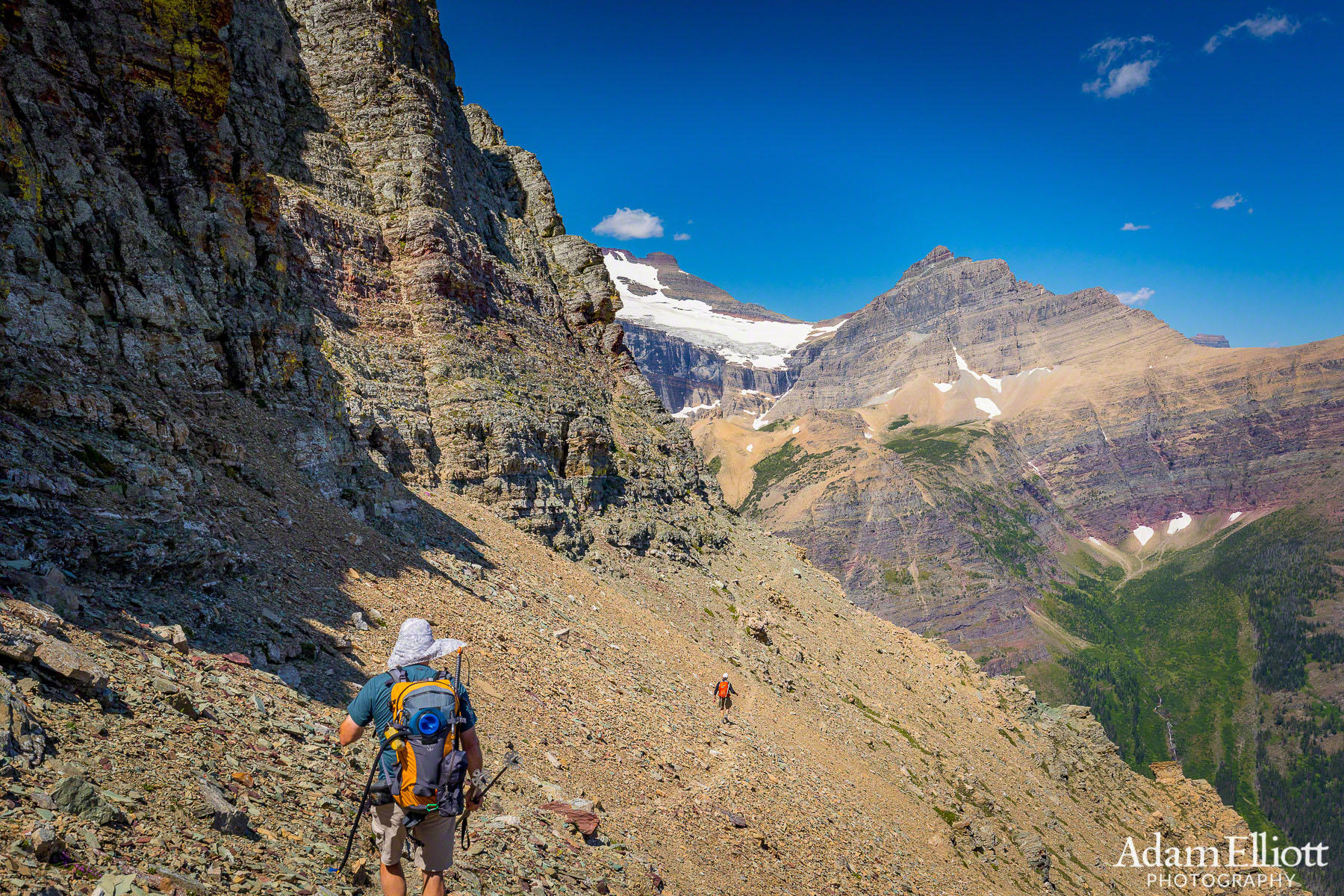
Looking off the wall at Swiftcurrent Valley. We climbed down this side to Ptarmigan Lake. It wasn’t easy, in fact, it might have been better to go back the way we came.

Down on the skree, looking back at Stephen and David after descending those cliffs. They were higher than they look from this perspective. Even those snow and rock slopes at the base of the cliffs were much higher/longer than they look. In fact you can see these slopes, snowfields and cliffs from a better perspective if you go back up to the photo of the switchbacks above Ptarmigan Lake. All of it is on the right side of that photo.

Finally back to the safety of the trail. I thought it would be easier when i got into the vegetation but it was even more treacherous than the rock slopes!

I had run out of water so we stopped at the lake. I really overestimated how much water would be available on the high slopes. Pretty dumb considering how obsessed with water i am in the desert. I had just remembered Glacier being a very wet place. On the other hand, I don’t think hanging out at this lake was too much of a burden for my mates.

My nemesis Mt. Wilbur looms ahead. Late day light made it a nice walk back.

We were going to eat at Swiftcurrent but they have changed the restaurant to more of a fast food affair with no wait staff, so we went to Many Glacier Hotel. View from the deck.