For print and purchase options
The Road to Uyuni
Bolivia: A Drive Where Almost Everything Went Wrong
Categories: Bolivia, Road Trips
We were done with our little canyoneering trips by lunch and we had time to go look at additional desert scenery to the NE of Tupiza but due to their very unorthodox town layout and weekend markets we were unable to access any road that exited the town in that direction. Frustrated, we decided we would simply leave and head to our next destination, Uyuni. The distance was just over 20km (130 miles) and should only have taken 4 hours. Instead it took us almost 7 hours and was possibly the most difficult drive I’ve done, in terms of having to fight for every mile of progress.
As soon as we left town the road was immediately destroyed. It was a major construction project we were diverted into a gravel riverbed with no real direction on where to go or how to get back to the road. As we traveled more and more miles down the river, with frequent water crossings, our GPS showed us consistently traveling away from the highway route. We were getting nervous because this went on for 30 miles. Finally we arrived back to the dirt highway but were only able to drive a few miles on it before we encountered an impassable roadblock in the middle of this tiny almost abandoned village. Again, we had to leave the road, find a way to cross a river, wind our way through horse cart trails across overgrown abandoned agricultural fields and eventually work our way back to the road to continue to the next obstacle.

As soon as we left town we were diverted into this river bed for 30 miles.

The outskirts of Tupiza reminded me of the Egytptian Desert.
These kinds of dilemmas went on for the entire day. Diversions, destruction, barriers, on and on. About midway through the trip we arrived in a particularly forlorn mining town on a hill. The streets of Atocha were so steep I had to build up momentum to make it up the hills, gaining speed at the bottom until i was going way to fast for the condition of the road and the density of the buildings. At the top we momentarily stopped to take a picture…. and the car died. After panicking for a minute we began to troubleshoot and quickly discovered that the roads had been so rough for the last week that the battery cables vibrated right off of the battery! Relieved to understand the problem were were shortly on our way and even discovered fresh new pavement for the first time all day!
The pavement didn’t last long. Our next dilemma was a bona fide sandstorm that made the road impassable. I have experience driving through deep sand and I knew our car wasn’t up to the task. Where we stopped on the road we found a minivan stuck in the sand 50 yards in front of us. We helped them get out, they were a Bolivian Indigenous family and it was a little hard to understand them in the blowing storm. They seemed to be wanting us to go with them, taking turns pushing each other out of the sand. That sounded like a nightmare so we turned around and found an alternative road that was longer.

Dust blows across the face of the very high Cerro Chorolque. At 18,110 ft / 5520 m it is the highest mountain in the region and visible from 100’s of miles away. Barely visible in this photo at the bottom of the left saddle is the highest village in Bolivia, Santa Barbara. The mountain is also home to the highest tin and bismuth mines in the world.

Wish we’d had time to check out this and many other areas.

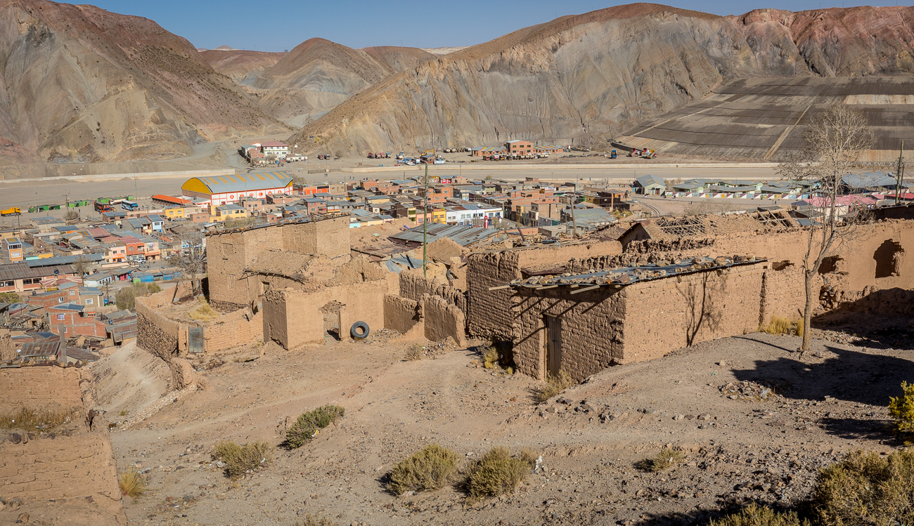
A remote mining town about midway through the day.

At the top of this hill our car broke down. Great place for a breakdown.

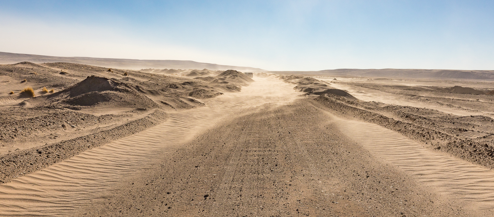
We got into some sandy desert and a large dunefield.
Eventually the dust storms we’d been dealing with turned into a sandstorm that buried the road. We stopped here but that van up the road was stuck.
Our newest route had its own sand problems. After only 20 minutes of progress we crested a hill and encountered a large jack knifed truck blocking the entire road with no way around. We waited 1/2 an hour with other trucks and watched other truckers fail with half baked plans to remove the vehicle. Ben convinced me to try another road, again going down to a river. This time we could not find a way across. But by this time during our trip we were definitely used to the absence of order in Bolivia and we decided to drive across a long railroad bridge, down a steep embankment and then across the river. From there it did not get worse, allowing us to reach Uyuni at sunset. Hilariously, Uyuni appeared to be straight out of a Mad Max movie. As we neared the abrupt entrance to town the road spread so wide it seemed to disappear. Three heavy trucks came bursting side by side out of the main street, curving sharply and engulfing all the people and vehicles nearby in a thick pile of dust glowing in the sun.

The jack knifed truck blocking the highway entirely.


The wonderful streets of Uyuni. We thought Uyuni would be better than Tupiza based on the formal grid of roads defining the town on maps. In reality it was much worse, and had a post apocalyptic feel to it. That is blowing dust in the background. Many street intersections had a large pile of garbage in the middle.

I went walking around at night to stretch my legs after another long day of driving.

We stayed in Hotel Julia, which claimed to have internet but did not, nor did it have reliable electricity. In fact, the entire town suffered from frequent blackouts.

These ‘food pods’ had a design that reminded me of Half Life 2.


Uyuni has a strange, dystopian Soviet feel to it.

The town looked better at night because you couldn’t see all the dirt.