Colorado: Engineer Pass
The West Half of the Alpine Loop in the San Juan Mountains
Categories: Colorado, Mountains, Road Trips
The San Juan Mountains are, in my opinion, the most scenic mountains Colorado has to offer. Covering the southwest portion of the state, they are the headwaters of the Animus, Gunnison, San Juan and Dolores rivers. On the other side of the continental divide, the Rio Grand originates on their eastern flanks. I love the little town of Ouray, in the bottom of a deep cirque.
The San Juan Mountains are a collection of unusually high peaks and valleys, with 13 summits over 14,000 feet. They also include La Garita Caldera. Gaping 47 miles wide (75 km), the super volcano was responsible for the most energetic event on the Earth since the asteroid that killed the dinosaurs. The volcanics produced a range rife with minerals and today the mountains are teeming with old leaking mines and ghost towns.

The road out of Silverton.

A clear mountain stream full of heavy metals.

Animas Forks
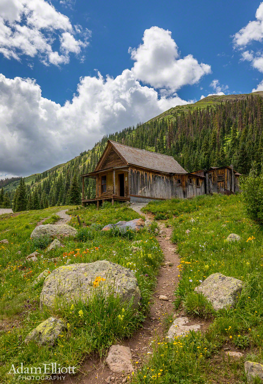

There were a whole lot of people at Animas Forks and some county rangers who told me my car would be fine on Country Road 18. I asked because of warnings on the map I had, and because it seemed like everyone had a jeep or ATV except me.

The San Juan Mountains are known as the Switzerland of America.

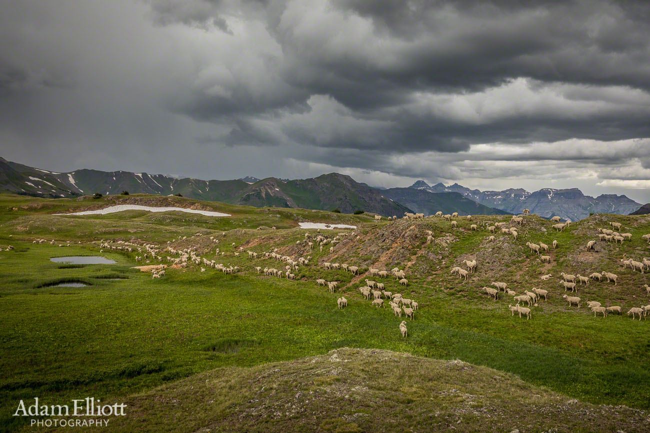
There were lots of sheep that came from somewhere.

Once we were high above tree line it started reminding of the places i missed in Alaska. Except those places were 10,000 feet lower.
Part of Colorado’s early history was the creation of a network of roads through the mountains, connecting all those towns. Today some of those roads have been incorporated into a grand scenic 4×4 by way, known as the Alpine Loop. The loop is 65 miles of mostly gravel roads and connects the towns of Lake City, Silverton and Ouray.
We started the loop by driving first to Silverton and heading up to Engineer Pass. After spending hours enjoying the scenery and the ghost town of Animas Forks we realized there wasn’t enough time to make the whole trip worthwhile, so I decided to head back down and take a “shortcut” back to Ouray, where we were staying.
All through the day thunderstorms had been building up over the mountains. By the time they hit us we were on the worst part of the whole trip, County Road 18. The Engineer Pass road is listed on the World’s Most Dangerous Roads site but it’s generally a fine road. I do agree with that site, however, when they say it can be a nightmare when wet. I also agree with this account that CR 18 “is so nasty that after a mile or so the fun goes away and after that it’s just plain work.” Of course, that is when it is dry. When the road is covered in icy hail, the dirt is soaked with heavy rain and waterfalls are pouring off the cliffs onto your car it is definitely stressful.

A very scenic vista about 2/3 of the way up to the pass from Animas Forks.
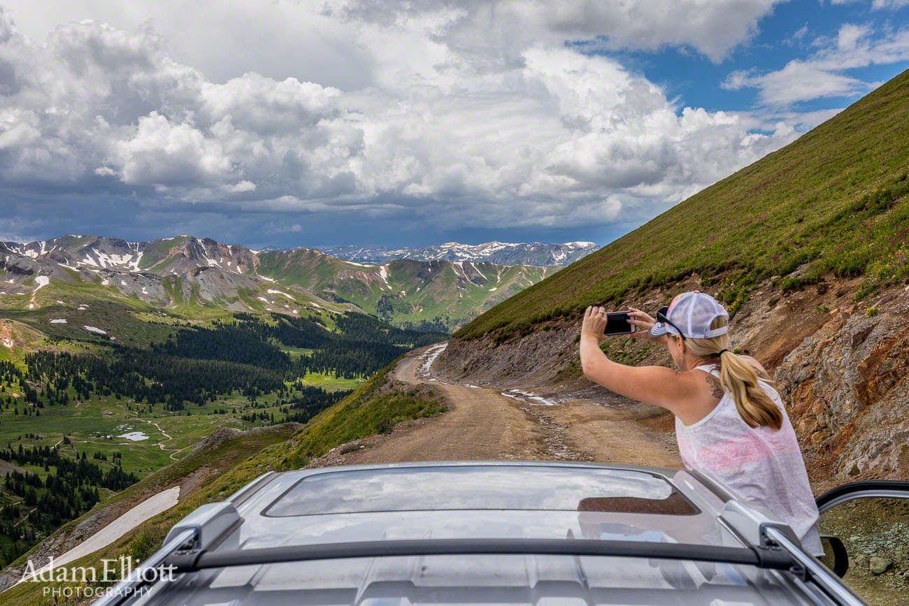
Maree snaps some pictures.

Up at the pass (12,800 ft.) looking across the rocks eastward towards Lake City.


We took a snack break at this idyllic valley, knowing the storms were on their way.
There are signs that, in addition to 4 wheel drive, “recommend” a short wheel base on CR 18. That is an understatement. For a while we were stuck behind a guy with a full length bed and extended cab. That guy was having a very bad time, and was tearing up his vehicle. The tight, rocky hairpins require choosing the path before the descent. In some places the bedrock drops a foot at a time and in one such place I temporarily got stuck teetering back and forth on two wheels while my transmission pointlessly tried to figure out what was going on. Two opposing wheels were stuck in rock wedges and could not get traction in the rain.
While I won’t do that section of road again the overall trip was spectacular. I look forward to returning and completing the loop, maybe from the Lake City side.

We left the sheep in the hail and lightning.

Back down to tree line, in the rain.

Driving along the top of a rocky canyon.


On the more manageable parts of the descent the waterfalls and rising mist offered some dramatic scenery that you wouldn’t normally see.

The clear mountain streams had turned muddy.

I’ll be doing other trips in the San Juans. I think Ouray is on the other side of this fine peaks.